
Magnitude |
:2.6 |
| Date & Time (UTC) | 2014-07-06 16:59:19.0 |
| Date & Time (Local) | 1393/4/15 21:29:19.0 |
| Location | Lat:38.56 Lon: 48.7 |
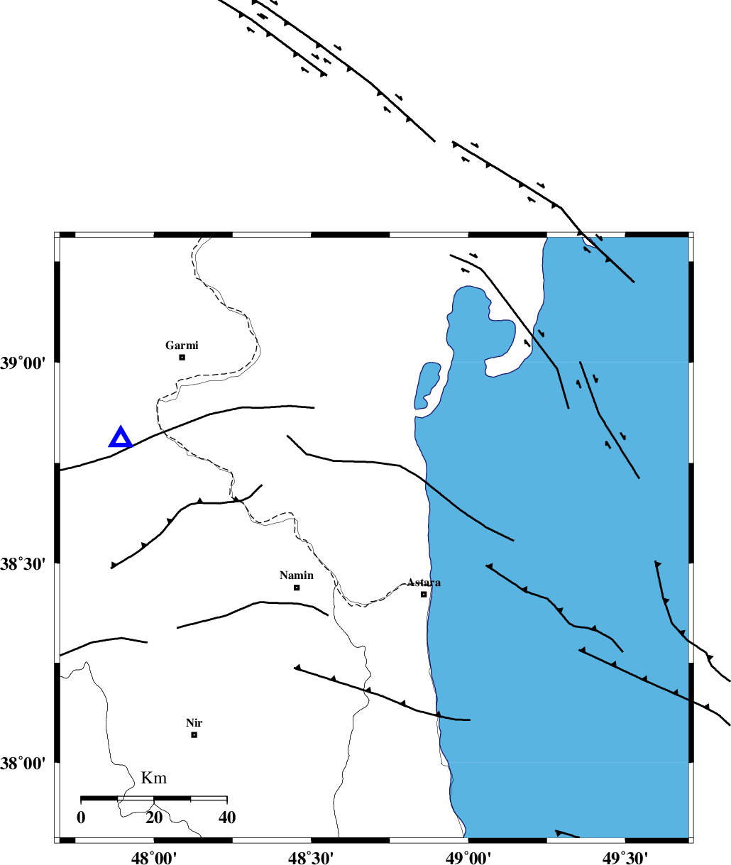
| Region | Azerbaijan, 21 km North-West of Astara |
Nearest Cities |
|
| 20 km North of Kiladeh, Gilan Province | |
| 21 km North West of Astara, Gilan Province | |
| 22 km North East of Anbaran, Ardebil Province | |
| 25 km North East of Namin, Ardebil Province | |
| 26 km North East of Nanehkaran, Ardebil Province | |
| Depth | 14 km |
| Agency | |
Faults within 150 km: |
|
| TALESH_F (Length: 258 km) , Distance to epicenter: 10 km | |
| SANGAVAR_F (Length: 61 km) , Distance to epicenter: 40 km | |
| BOZQUSH (Length: 70 km) , Distance to epicenter: 56 km | |
| Number of Phases | 5 |
| RMS | 0 |
| Number of Stations | 3 |
| Error in Latitude | >2.5 km |
| Error in Longitude | 4.9 km |
| Error in Depth | 5.8 km |
Download waveform in seisan format
to download seisan software Click here
to access information about IIEES stations Click here
Amplitude | ||||||||
| UID | Agency | Station | Component | Amplitude | Period | Arrival Time | Proccessing Time | Signal Clip |
| 92759 | IIEES | GRMI | E | 275.7 | 0.12 | 2014-07-06 16:59:42 | 2014-07-06 06:30:00 | n |
Phase | ||||||||||||
| Agency | Station | Component | Phase Type | Phase Quality | First Motion | Observed Arrival Time | Time Residual | Loc. Flag | Input Weight | Distance | Azimuth | |
| IIEES | GRMI | Z | Pg | E | 2014-07-06 16:59:32 | 0.04 | y | 74.9 | 292 | |||
| IIEES | GRMI | N | Sg | E | 2014-07-06 16:59:41 | -0.03 | y | 74.9 | 292 | |||
| IIEES | ZNJK | Z | Pn | E | 2014-07-06 16:59:53 | 0.05 | y | 210 | 180 | |||
| IIEES | ZNJK | E | Sg | E | 2014-07-06 17:00:18 | -0.01 | y | 210 | 180 | |||
| IIEES | CHTH | Z | Pn | E | 2014-07-06 17:00:12 | -0.05 | y | 365 | 143 | |||