
Magnitude |
:3.6 |
| Date & Time (UTC) | 2014-07-05 18:52:25.7 |
| Date & Time (Local) | 1393/4/14 23:22:25.7 |
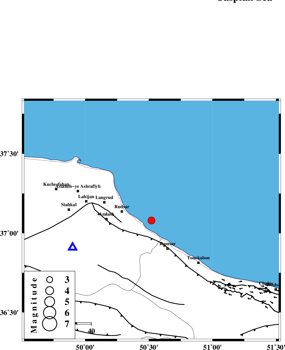
| Location | Lat:37.08 Lon: 50.52 |
| Region | Caspian Sea, 21 km East of Rudsar |
Nearest Cities |
|
| 11 km North East of Vajargah, Gilan Province | |
| 12 km North of Chaboksar, Gilan Province | |
| 17 km East of Rezamahalleh, Gilan Province | |
| 18 km North East of Rahimabad, Gilan Province | |
| 19 km North West of Galesh mahalleh, Mazandaran Province | |
| Depth | 14 km |
| Agency | |
Faults within 150 km: |
|
| KHAZAR_F (Length: 523 km) , Distance to epicenter: 12 km | |
| LAHIJAN_F (Length: 92 km) , Distance to epicenter: 21 km | |
| BONAN_F (Length: 74 km) , Distance to epicenter: 44 km | |
| Number of Phases | 9 |
| RMS | 0.4 |
| Number of Stations | 7 |
| Error in Latitude | >4.4 km |
| Error in Longitude | 5.5 km |
| Error in Depth | 8.7 km |
Download waveform in seisan format
to download seisan software Click here
to access information about IIEES stations Click here
Amplitude | ||||||||
| UID | Agency | Station | Component | Amplitude | Period | Arrival Time | Proccessing Time | Signal Clip |
| 92749 | IIEES | ASAO | N | 252.8 | 0.23 | 2014-07-05 18:53:47 | 2014-07-06 05:34:00 | n |
Phase | ||||||||||||
| Agency | Station | Component | Phase Type | Phase Quality | First Motion | Observed Arrival Time | Time Residual | Loc. Flag | Input Weight | Distance | Azimuth | |
| IIEES | CHTH | Z | Pg | E | 2014-07-05 18:52:49 | 0.07 | y | 141 | 157 | |||
| IIEES | CHTH | E | Sg | E | 2014-07-05 18:53:06 | -0.22 | y | 141 | 157 | |||
| IIEES | ZNJK | Z | Pg | E | 2014-07-05 18:52:54 | 0.22 | y | 169 | 255 | |||
| IIEES | ASAO | Z | Pn | E | 2014-07-05 18:53:09 | 0.23 | y | 284 | 189 | |||
| IIEES | ASAO | N | Sg | E | 2014-07-05 18:53:45 | -0.4 | y | 284 | 189 | |||
| IIEES | GHVR | Z | Pn | E | 2014-07-05 18:53:10 | 0.7 | y | 296 | 167 | |||
| IIEES | GRMI | Z | Pn | E | 2014-07-05 18:53:10 | -0.47 | y | 300 | 311 | |||
| IIEES | SHRO | Z | Pn | E | 2014-07-05 18:53:36 | -0.25 | y | 506 | 102 | |||
| IIEES | YZKH | Z | Pn | E | 2014-07-05 18:53:53 | 0.05 | y | 640 | 143 | |||