
Magnitude |
:2.7 |
| Date & Time (UTC) | 2014-06-30 16:35:38.1 |
| Date & Time (Local) | 1393/4/9 21:05:38.1 |
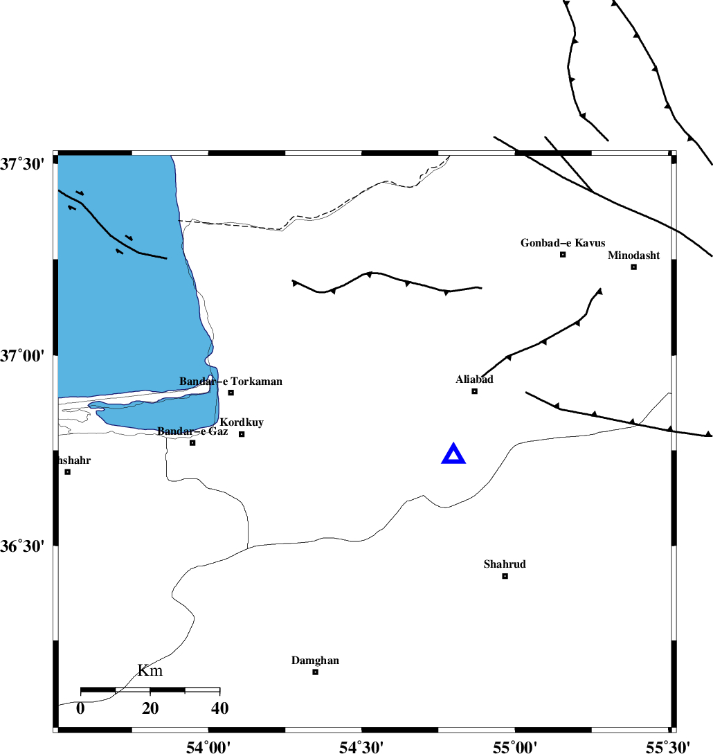
| Location | Lat:36.77 Lon: 54.51 |
| Region | Golestan Province, 10 km Gorgan |
Nearest Cities |
|
| 9 km of Jalin olia, Golestan Province | |
| 10 km of Gorgan, Golestan Province | |
| 13 km North of Naharkhoran, Golestan Province | |
| 18 km East of Lamsak, Golestan Province | |
| 24 km South of Nodeh malek, Golestan Province | |
| Depth | 18 km |
| Agency | |
Faults within 150 km: |
|
| KHAZAR_F (Length: 523 km) , Distance to epicenter: 9 km | |
| N_ALBORZ_F (Length: 360 km) , Distance to epicenter: 20 km | |
| SHAVAR_F (Length: 87 km) , Distance to epicenter: 24 km | |
| Number of Phases | 4 |
| RMS | 0 |
| Number of Stations | 3 |
| Error in Latitude | >2.9 km |
| Error in Longitude | 7.5 km |
| Error in Depth | 7.8 km |
Download waveform in seisan format
to download seisan software Click here
to access information about IIEES stations Click here
Amplitude | ||||||||
| UID | Agency | Station | Component | Amplitude | Period | Arrival Time | Proccessing Time | Signal Clip |
| 92709 | IIEES | TABS | N | 13.1 | 0.6 | 2014-06-30 16:37:45 | 2014-06-30 06:51:00 | n |
Phase | ||||||||||||
| Agency | Station | Component | Phase Type | Phase Quality | First Motion | Observed Arrival Time | Time Residual | Loc. Flag | Input Weight | Distance | Azimuth | |
| IIEES | SHRO | Z | Pg | E | 2014-06-30 16:36:04 | 0.02 | y | 159 | 122 | |||
| IIEES | SHRO | E | Sg | E | 2014-06-30 16:36:23 | -0.01 | y | 159 | 122 | |||
| IIEES | BJRD | Z | Pg | E | 2014-06-30 16:36:23 | -0.01 | y | 277 | 67 | |||
| IIEES | TABS | Z | Pn | E | 2014-06-30 16:36:37 | 0 | y | 420 | 145 | |||