
Magnitude |
:3.7 |
| Date & Time (UTC) | 2014-06-25 00:01:34.0 |
| Date & Time (Local) | 1393/4/4 04:31:34.0 |
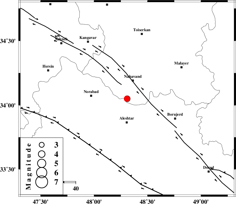
| Location | Lat:34.05 Lon: 48.31 |
| Region | Hamedan Province, 20 km North of Aleshtar |
Nearest Cities |
|
| 15 km West of Babaqasem, Hamedan Province | |
| 15 km South of Gian, Hamedan Province | |
| 17 km South of Nahavand, Hamedan Province | |
| 20 km South of Barzul, Hamedan Province | |
| 20 km North of Dehrahim, Lorestan Province | |
| Depth | 17 km |
| Agency | |
Faults within 150 km: |
|
| SAHANEH_F (Length: 77 km) , Distance to epicenter: 13 km | |
| NAHAVAND_F (Length: 102 km) , Distance to epicenter: 13 km | |
| DORUD (Length: 100 km) , Distance to epicenter: 49 km | |
| Number of Phases | 5 |
| RMS | 0 |
| Number of Stations | 5 |
| Error in Latitude | >2.3 km |
| Error in Longitude | 1.9 km |
| Error in Depth | 3.5 km |
Download waveform in seisan format
to download seisan software Click here
to access information about IIEES stations Click here
Amplitude | ||||||||
| UID | Agency | Station | Component | Amplitude | Period | Arrival Time | Proccessing Time | Signal Clip |
| 92667 | IIEES | SHGR | N | 507.3 | 0.4 | 2014-06-25 00:02:45 | 2014-06-25 01:20:00 | n |
| 92668 | IIEES | SHGR | E | 711.2 | 0.56 | 2014-06-25 00:02:50 | 2014-06-25 01:20:00 | n |
Phase | ||||||||||||
| Agency | Station | Component | Phase Type | Phase Quality | First Motion | Observed Arrival Time | Time Residual | Loc. Flag | Input Weight | Distance | Azimuth | |
| IIEES | SNGE | Z | Pg | E | 2014-06-25 00:01:58 | 0.01 | y | 146 | 323 | |||
| IIEES | KHMZ | Z | Pg | E | 2014-06-25 00:02:00 | 0.03 | y | 157 | 102 | |||
| IIEES | ASAO | Z | Pg | E | 2014-06-25 00:02:01 | -0.04 | y | 168 | 70 | |||
| IIEES | SHGR | Z | Pn | E | 2014-06-25 00:02:08 | -0.02 | y | 220 | 168 | |||
| IIEES | GHVR | Z | Pn | E | 2014-06-25 00:02:15 | 0.02 | y | 275 | 79 | |||