
Magnitude |
:3 |
| Date & Time (UTC) | 2014-06-22 17:44:13.4 |
| Date & Time (Local) | 1393/4/1 22:14:13.4 |
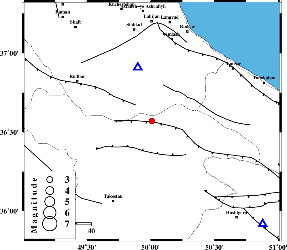
| Location | Lat:36.57 Lon: 50.01 |
| Region | Ghazvin Province, 34 km North of Qazvin |
Nearest Cities |
|
| 18 km South of Kelishom, Gilan Province | |
| 25 km South East of Jirhandeh, Gilan Province | |
| 28 km North West of Rajaeedasht, Ghazvin Province | |
| 31 km North East of Mahmud Abad, Ghazvin Province | |
| 33 km South East of Barresar, Gilan Province | |
| Depth | 14 km |
| Agency | |
Faults within 150 km: |
|
| ALAMUTRUD_F (Length: 140 km) , Distance to epicenter: 2 km | |
| RUDBAR_F (Length: 93 km) , Distance to epicenter: 16 km | |
| N_QAZVIN_F (Length: 72 km) , Distance to epicenter: 22 km | |
| Number of Phases | 6 |
| RMS | 0.1 |
| Number of Stations | 6 |
| Error in Latitude | >1.9 km |
| Error in Longitude | 2.1 km |
| Error in Depth | 2.9 km |
Download waveform in seisan format
to download seisan software Click here
to access information about IIEES stations Click here
Amplitude | ||||||||
| UID | Agency | Station | Component | Amplitude | Period | Arrival Time | Proccessing Time | Signal Clip |
| 92660 | IIEES | THKV | N | 358.9 | 0.12 | 2014-06-22 17:44:33 | 2014-06-22 07:03:00 | n |
| 92661 | IIEES | THKV | E | 438.4 | 0.12 | 2014-06-22 17:44:33 | 2014-06-22 07:03:00 | n |
Phase | ||||||||||||
| Agency | Station | Component | Phase Type | Phase Quality | First Motion | Observed Arrival Time | Time Residual | Loc. Flag | Input Weight | Distance | Azimuth | |
| IIEES | ZNJK | Z | Pg | E | 2014-06-22 17:44:33 | -0.01 | y | 119 | 276 | |||
| IIEES | CHTH | Z | Pg | E | 2014-06-22 17:44:34 | -0.11 | y | 125 | 126 | |||
| IIEES | ASAO | Z | Pn | E | 2014-06-22 17:44:49 | 0.03 | y | 225 | 180 | |||
| IIEES | ASAO | N | Sg | E | 2014-06-22 17:45:17 | -0.02 | y | 225 | 180 | |||
| IIEES | GHVR | Z | Pn | E | 2014-06-22 17:44:53 | 0.15 | y | 258 | 154 | |||
| IIEES | SNGE | Z | Pn | E | 2014-06-22 17:44:57 | -0.04 | y | 291 | 236 | |||