
Magnitude |
:2.6 |
| Date & Time (UTC) | 2014-06-16 23:14:44.3 |
| Date & Time (Local) | 1393/3/27 03:44:44.3 |
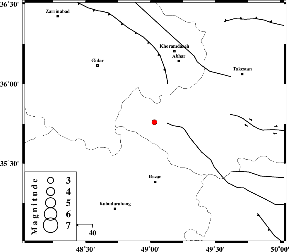
| Location | Lat:35.76 Lon: 49.03 |
| Region | Ghazvin Province, 42 km North of Razan |
Nearest Cities |
|
| 23 km North West of Ab-e garm, Ghazvin Province | |
| 27 km North West of Avaj, Ghazvin Province | |
| 33 km North East of Kahla, Zanjan Province | |
| 34 km North East of Khorandeh, Hamedan Province | |
| 35 km South West of Darsajin, Zanjan Province | |
| Depth | 18 km |
| Agency | |
Faults within 150 km: |
|
| KUSHK_E_NOSRAT_F (Length: 230 km) , Distance to epicenter: 9 km | |
| SOLTANIYEH_F (Length: 119 km) , Distance to epicenter: 28 km | |
| ZANJAN_F (Length: 137 km) , Distance to epicenter: 51 km | |
| Number of Phases | 6 |
| RMS | 0.1 |
| Number of Stations | 4 |
| Error in Latitude | >5.2 km |
| Error in Longitude | 8.6 km |
| Error in Depth | 11.4 km |
Download waveform in seisan format
to download seisan software Click here
to access information about IIEES stations Click here
Amplitude | ||||||||
| UID | Agency | Station | Component | Amplitude | Period | Arrival Time | Proccessing Time | Signal Clip |
| 92634 | IIEES | THKV | E | 74 | 0.52 | 2014-06-16 23:15:32 | 2014-06-17 01:46:00 | n |
Phase | ||||||||||||
| Agency | Station | Component | Phase Type | Phase Quality | First Motion | Observed Arrival Time | Time Residual | Loc. Flag | Input Weight | Distance | Azimuth | |
| IIEES | KHMZ | Z | Pn | E | 2014-06-16 23:15:21 | 0.12 | y | 240 | 159 | |||
| IIEES | KHMZ | E | Sg | E | 2014-06-16 23:15:52 | -0.04 | y | 240 | 159 | |||
| IIEES | GHVR | Z | Pn | E | 2014-06-16 23:15:22 | -0.12 | y | 247 | 125 | |||
| IIEES | GHVR | E | Sg | E | 2014-06-16 23:15:54 | 0.03 | y | 247 | 125 | |||
| IIEES | DAMV | Z | Pn | E | 2014-06-16 23:15:24 | 0 | y | 267 | 92 | |||
| IIEES | DAMV | E | Sg | E | 2014-06-16 23:15:59 | 0.01 | y | 267 | 92 | |||