
Magnitude |
:2.7 |
| Date & Time (UTC) | 2014-06-16 02:29:12.8 |
| Date & Time (Local) | 1393/3/26 06:59:12.8 |
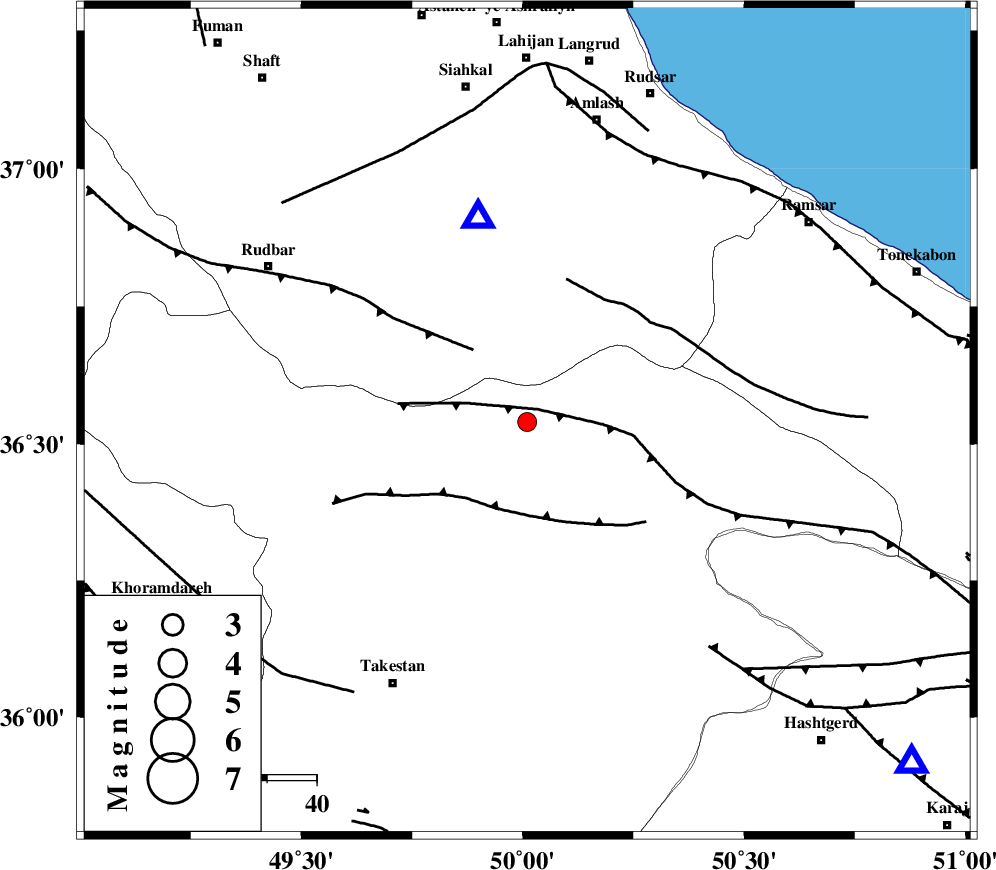
| Location | Lat:36.54 Lon: 50.01 |
| Region | Ghazvin Province, 30 km North of Qazvin |
Nearest Cities |
|
| 21 km South of Kelishom, Gilan Province | |
| 27 km North West of Rajaeedasht, Ghazvin Province | |
| 27 km South East of Jirhandeh, Gilan Province | |
| 28 km North East of Mahmud Abad, Ghazvin Province | |
| 30 km North of Qazvin, Ghazvin Province | |
| Depth | 14 km |
| Agency | |
Faults within 150 km: |
|
| ALAMUTRUD_F (Length: 140 km) , Distance to epicenter: 3 km | |
| RUDBAR_F (Length: 93 km) , Distance to epicenter: 18 km | |
| N_QAZVIN_F (Length: 72 km) , Distance to epicenter: 19 km | |
| Number of Phases | 5 |
| RMS | 0 |
| Number of Stations | 3 |
| Error in Latitude | >2.1 km |
| Error in Longitude | 3.7 km |
| Error in Depth | 4.9 km |
Download waveform in seisan format
to download seisan software Click here
to access information about IIEES stations Click here
Amplitude | ||||||||
| UID | Agency | Station | Component | Amplitude | Period | Arrival Time | Proccessing Time | Signal Clip |
| 92619 | IIEES | GHVR | E | 44.3 | 0.44 | 2014-06-16 02:30:27 | 2014-06-16 03:58:00 | n |
Phase | ||||||||||||
| Agency | Station | Component | Phase Type | Phase Quality | First Motion | Observed Arrival Time | Time Residual | Loc. Flag | Input Weight | Distance | Azimuth | |
| IIEES | GHVR | Z | Pn | E | 2014-06-16 02:29:52 | 0.01 | y | 254 | 154 | |||
| IIEES | GHVR | N | Sg | E | 2014-06-16 02:30:24 | -0.01 | y | 254 | 154 | |||
| IIEES | KHMZ | Z | Pn | E | 2014-06-16 02:29:59 | -0.01 | y | 311 | 181 | |||
| IIEES | KHMZ | E | Sg | E | 2014-06-16 02:30:40 | 0.01 | y | 311 | 181 | |||
| IIEES | GRMI | Z | Pn | E | 2014-06-16 02:29:59 | 0 | y | 314 | 324 | |||