
Magnitude |
:3.1 |
| Date & Time (UTC) | 2014-06-15 23:40:09.1 |
| Date & Time (Local) | 1393/3/26 04:10:09.1 |
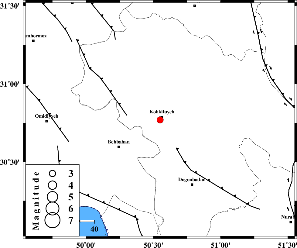
| Location | Lat:30.77 Lon: 50.55 |
| Region | Kohkiluieh va boyerahmad Province, 2 km Dehdasht |
Nearest Cities |
|
| 2 km of Dehdasht, Kohkiluieh va boyerahmad Province | |
| 24 km South West of Savari, Kohkiluieh va boyerahmad Province | |
| 26 km South East of Lendeh, Kohkiluieh va boyerahmad Province | |
| 29 km North East of Mansuriyeh, Khoozestan Province | |
| 35 km North East of Behbahan, Khoozestan Province | |
| Depth | 14 km |
| Agency | |
Faults within 150 km: |
|
| MISHAN_F (Length: 76 km) , Distance to epicenter: 23 km | |
| MFF4 (Length: 62 km) , Distance to epicenter: 24 km | |
| MFF2 (Length: 205 km) , Distance to epicenter: 65 km | |
| Number of Phases | 6 |
| RMS | 0 |
| Number of Stations | 5 |
| Error in Latitude | >1.7 km |
| Error in Longitude | 4.1 km |
| Error in Depth | 6.9 km |
Download waveform in seisan format
to download seisan software Click here
to access information about IIEES stations Click here
Amplitude | ||||||||
| UID | Agency | Station | Component | Amplitude | Period | Arrival Time | Proccessing Time | Signal Clip |
| 92614 | IIEES | SHGR | E | 134.5 | 0.44 | 2014-06-15 23:41:13 | 2014-06-16 01:23:00 | n |
| 92615 | IIEES | SHGR | N | 177.1 | 0.36 | 2014-06-15 23:41:14 | 2014-06-16 01:23:00 | n |
Phase | ||||||||||||
| Agency | Station | Component | Phase Type | Phase Quality | First Motion | Observed Arrival Time | Time Residual | Loc. Flag | Input Weight | Distance | Azimuth | |
| IIEES | AHRM | Z | Pn | E | 2014-06-15 23:40:44 | -0.02 | y | 223 | 161 | |||
| IIEES | SHGR | Z | Pn | E | 2014-06-15 23:40:44 | 0.09 | y | 223 | 312 | |||
| IIEES | SHGR | E | Sg | E | 2014-06-15 23:41:12 | -0.02 | y | 223 | 312 | |||
| IIEES | KHMZ | Z | Pn | E | 2014-06-15 23:40:58 | -0.03 | y | 334 | 351 | |||
| IIEES | GHVR | Z | Pn | E | 2014-06-15 23:41:08 | 0.01 | y | 416 | 9 | |||
| IIEES | ASAO | Z | Pn | E | 2014-06-15 23:41:09 | -0.03 | y | 422 | 353 | |||