
Magnitude |
:3.2 |
| Date & Time (UTC) | 2014-06-03 05:30:32.8 |
| Date & Time (Local) | 1393/3/13 10:00:32.8 |
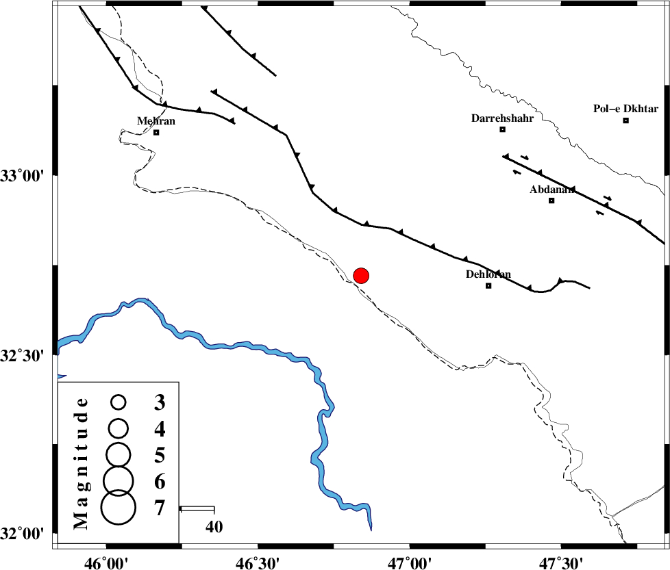
| Location | Lat:32.72 Lon: 46.84 |
| Region | Ilam Province, 39 km West of Dehloran |
Nearest Cities |
|
| 17 km South West of Bishehzar, Ilam Province | |
| 39 km North West of Dehloran, Ilam Province | |
| 52 km North West of Musian, Ilam Province | |
| 58 km South of Meymeh, Ilam Province | |
| 62 km South West of Badreh, Ilam Province | |
| Depth | 14 km |
| Agency | |
Faults within 150 km: |
|
| MFF6 (Length: 144 km) , Distance to epicenter: 16 km | |
| BALARUD_F_Z1 (Length: 87 km) , Distance to epicenter: 57 km | |
| ZFF4 (Length: 128 km) , Distance to epicenter: 61 km | |
| Number of Phases | 6 |
| RMS | 0.1 |
| Number of Stations | 5 |
| Error in Latitude | >3.8 km |
| Error in Longitude | 5.3 km |
| Error in Depth | 8.1 km |
Download waveform in seisan format
to download seisan software Click here
to access information about IIEES stations Click here
Amplitude | ||||||||
| UID | Agency | Station | Component | Amplitude | Period | Arrival Time | Proccessing Time | Signal Clip |
| 92546 | IIEES | SHGR | N | 275.3 | 0.6 | 2014-06-03 05:31:36 | 2014-06-03 09:12:00 | n |
| 92547 | IIEES | SHGR | E | 236.1 | 0.6 | 2014-06-03 05:31:45 | 2014-06-03 09:12:00 | n |
Phase | ||||||||||||
| Agency | Station | Component | Phase Type | Phase Quality | First Motion | Observed Arrival Time | Time Residual | Loc. Flag | Input Weight | Distance | Azimuth | |
| IIEES | SHGR | Z | Pg | E | 2014-06-03 05:31:04 | -0.06 | y | 196 | 110 | |||
| IIEES | SNGE | Z | Pn | E | 2014-06-03 05:31:13 | -0.18 | y | 268 | 10 | |||
| IIEES | KHMZ | Z | Pn | E | 2014-06-03 05:31:19 | -0.02 | y | 312 | 68 | |||
| IIEES | KHMZ | E | Sg | E | 2014-06-03 05:32:00 | -0.05 | y | 312 | 68 | |||
| IIEES | ASAO | Z | Pn | E | 2014-06-03 05:31:25 | 0.28 | y | 358 | 55 | |||
| IIEES | ZNJK | Z | Pn | E | 2014-06-03 05:31:39 | 0.08 | y | 470 | 21 | |||