
Magnitude |
:2.9 |
| Date & Time (UTC) | 2014-05-11 18:58:36.9 |
| Date & Time (Local) | 1393/2/21 23:28:36.9 |
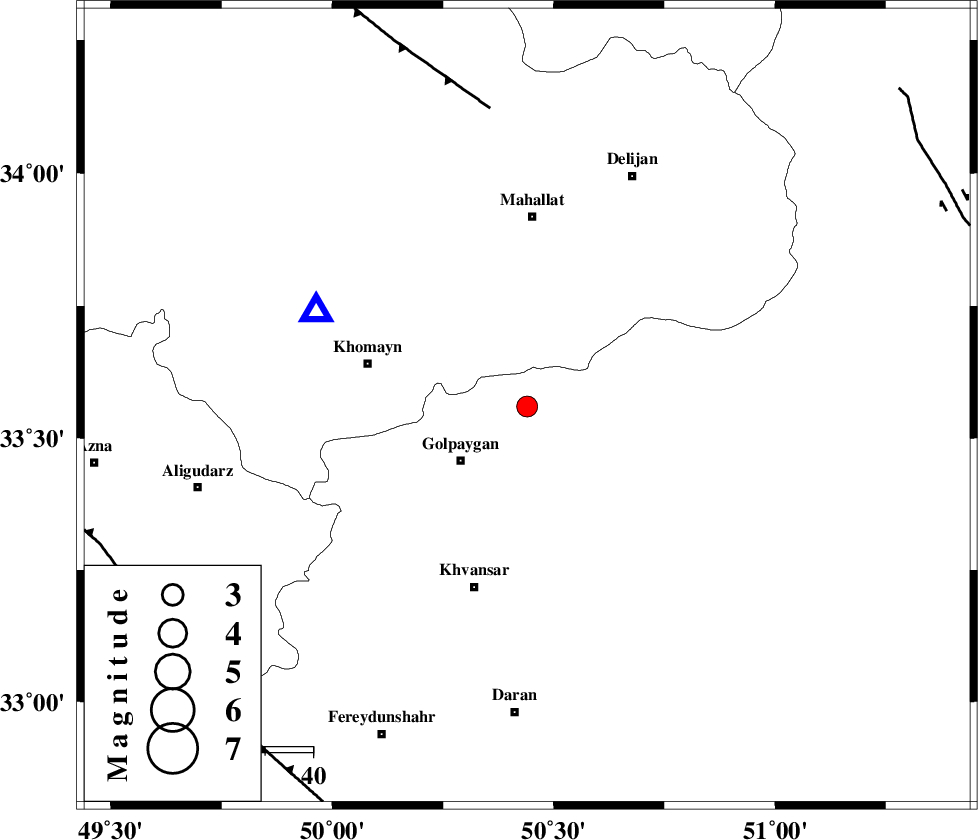
| Location | Lat:33.56 Lon: 50.44 |
| Region | Esfahan Province, 18 km East of Golpayegan |
Nearest Cities |
|
| 6 km North of Konjedkhan, Esfahan Province | |
| 9 km North of Saeedabad, Esfahan Province | |
| 13 km North of Gogad, Esfahan Province | |
| 13 km North of Nivan nar, Esfahan Province | |
| 18 km North East of Golpayegan, Esfahan Province | |
| Depth | 14 km |
| Agency | |
Faults within 150 km: |
|
| TAFRESH_F (Length: 117 km) , Distance to epicenter: 63 km | |
| MAIN_ZAGROS_R_F (Length: 1106 km) , Distance to epicenter: 89 km | |
| ARDAL_F (Length: 170 km) , Distance to epicenter: 95 km | |
| Number of Phases | 5 |
| RMS | 0 |
| Number of Stations | 3 |
| Error in Latitude | >2 km |
| Error in Longitude | 1.9 km |
| Error in Depth | 4.5 km |
Download waveform in seisan format
to download seisan software Click here
to access information about IIEES stations Click here
Amplitude | ||||||||
| UID | Agency | Station | Component | Amplitude | Period | Arrival Time | Proccessing Time | Signal Clip |
| 92404 | IIEES | KHMZ | E | 963.6 | 0.12 | 2014-05-11 18:58:53 | 2014-05-11 08:29:00 | n |
Phase | ||||||||||||
| Agency | Station | Component | Phase Type | Phase Quality | First Motion | Observed Arrival Time | Time Residual | Loc. Flag | Input Weight | Distance | Azimuth | |
| IIEES | KHMZ | Z | Pg | E | 2014-05-11 18:58:45 | 0 | y | 48.9 | 295 | |||
| IIEES | ASAO | Z | Pg | E | 2014-05-11 18:58:56 | -0.04 | y | 117 | 341 | |||
| IIEES | ASAO | N | Sg | E | 2014-05-11 18:59:11 | 0.03 | y | 117 | 341 | |||
| IIEES | YZKH | Z | Pn | E | 2014-05-11 18:59:35 | 0.05 | y | 409 | 107 | |||
| IIEES | YZKH | E | Sg | E | 2014-05-11 19:00:31 | -0.03 | y | 409 | 107 | |||