
Magnitude |
:2.8 |
| Date & Time (UTC) | 2014-05-07 19:56:15.6 |
| Date & Time (Local) | 1393/2/18 00:26:15.6 |
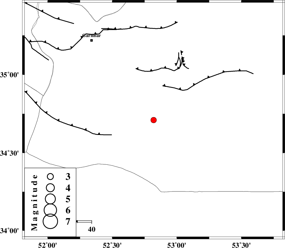
| Location | Lat:34.71 Lon: 52.82 |
| Region | Semnan Province, 72 km South-East of Garmsar |
Nearest Cities |
|
| 62 km South East of Kohanabad, Semnan Province | |
| 63 km South East of Gardovan, Semnan Province | |
| 65 km South East of Davarabad, Semnan Province | |
| 65 km South East of Aradan, Semnan Province | |
| 70 km South East of Lajran, Semnan Province | |
| Depth | 14 km |
| Agency | |
Faults within 150 km: |
|
| KUH_E_GUGERD_F (Length: 73 km) , Distance to epicenter: 25 km | |
| SIAHKUH_F (Length: 154 km) , Distance to epicenter: 29 km | |
| KUH_E_GACHAB_F1 (Length: 53 km) , Distance to epicenter: 36 km | |
| Number of Phases | 6 |
| RMS | 0.1 |
| Number of Stations | 6 |
| Error in Latitude | >2.4 km |
| Error in Longitude | 2.3 km |
| Error in Depth | 4.2 km |
Download waveform in seisan format
to download seisan software Click here
to access information about IIEES stations Click here
Amplitude | ||||||||
| UID | Agency | Station | Component | Amplitude | Period | Arrival Time | Proccessing Time | Signal Clip |
| 92358 | IIEES | THKV | E | 74.7 | 0.36 | 2014-05-07 19:57:13 | 2014-05-07 09:27:00 | n |
Phase | ||||||||||||
| Agency | Station | Component | Phase Type | Phase Quality | First Motion | Observed Arrival Time | Time Residual | Loc. Flag | Input Weight | Distance | Azimuth | |
| IIEES | DAMV | Z | Pg | E | 2014-05-07 19:56:37 | 0.01 | y | 128 | 323 | |||
| IIEES | GHVR | Z | Pg | E | 2014-05-07 19:56:40 | -0.02 | y | 147 | 261 | |||
| IIEES | GHVR | E | Sg | E | 2014-05-07 19:56:57 | -0.03 | y | 147 | 261 | |||
| IIEES | ASAO | Z | Pn | E | 2014-05-07 19:56:55 | -0.09 | y | 257 | 267 | |||
| IIEES | KHMZ | Z | Pn | E | 2014-05-07 19:56:58 | 0.18 | y | 284 | 249 | |||
| IIEES | YZKH | Z | Pn | E | 2014-05-07 19:57:01 | -0.04 | y | 305 | 147 | |||