
Magnitude |
:3.8 |
| Date & Time (UTC) | 2014-05-06 13:28:23.0 |
| Date & Time (Local) | 1393/2/16 17:58:23.0 |
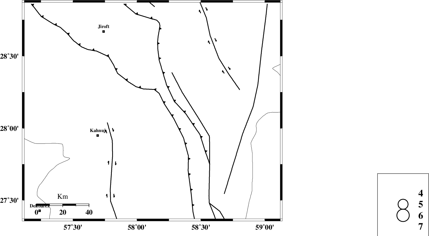
| Location | Lat:28.12 Lon: 58.12 |
| Region | Kerman Province, 46 km North-East of Kahnuj |
Nearest Cities |
|
| 26 km South of Mardehak, Kerman Province | |
| 38 km South East of Dosari, Kerman Province | |
| 40 km North West of Borj-e abbasabad, Kerman Province | |
| 43 km South East of Aliabad-e qadiri, Kerman Province | |
| 46 km North East of Kahnuj, Kerman Province | |
| Depth | 16 km |
| Agency | |
Faults within 150 km: |
|
| JIROFT_F (Length: 144 km) , Distance to epicenter: 36 km | |
| SABZEVARAN_F (Length: 190 km) , Distance to epicenter: 42 km | |
| BAM_F (Length: 118 km) , Distance to epicenter: 65 km | |
| Number of Phases | 5 |
| RMS | 0.1 |
| Number of Stations | 3 |
| Error in Latitude | >4.7 km |
| Error in Longitude | 6.5 km |
| Error in Depth | 4.6 km |
Download waveform in seisan format
to download seisan software Click here
to access information about IIEES stations Click here
Amplitude | ||||||||
| UID | Agency | Station | Component | Amplitude | Period | Arrival Time | Proccessing Time | Signal Clip |
| 92352 | IIEES | BNDS | N | 746.1 | 0.4 | 2014-05-06 13:29:24 | 2014-05-06 02:52:00 | n |
Phase | ||||||||||||
| Agency | Station | Component | Phase Type | Phase Quality | First Motion | Observed Arrival Time | Time Residual | Loc. Flag | Input Weight | Distance | Azimuth | |
| IIEES | BNDS | Z | Pg | E | 2014-05-06 13:28:57 | 0.14 | y | 208 | 248 | |||
| IIEES | BNDS | N | Sg | E | 2014-05-06 13:29:21 | -0.13 | y | 208 | 248 | |||
| IIEES | KRBR | Z | Pn | E | 2014-05-06 13:29:01 | 0.12 | y | 245 | 328 | |||
| IIEES | BSRN | Z | Pn | E | 2014-05-06 13:29:24 | -0.16 | y | 437 | 13 | |||
| IIEES | BSRN | E | Sg | E | 2014-05-06 13:30:25 | -0.02 | y | 437 | 13 | |||