
Magnitude |
:3.2 |
| Date & Time (UTC) | 2014-05-01 04:19:01.7 |
| Date & Time (Local) | 1393/2/11 08:49:01.7 |
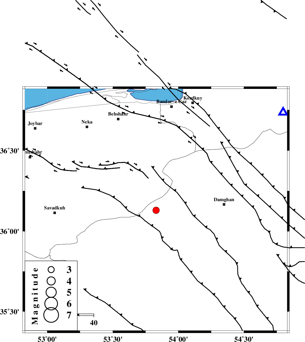
| Location | Lat:36.13 Lon: 53.83 |
| Region | Semnan Province, 47 km West of Damghan |
Nearest Cities |
|
| 15 km East of Talma darreh, Mazandaran Province | |
| 16 km North of Darvar, Semnan Province | |
| 29 km South East of Kiasar, Mazandaran Province | |
| 30 km North West of Seydabad, Semnan Province | |
| 31 km North West of Amirabad, Semnan Province | |
| Depth | 18 km |
| Agency | |
Faults within 150 km: |
|
| DAMGHAN_F (Length: 95 km) , Distance to epicenter: 2 km | |
| ATARI_F (Length: 185 km) , Distance to epicenter: 19 km | |
| ASTANEH_F (Length: 72 km) , Distance to epicenter: 19 km | |
| Number of Phases | 9 |
| RMS | 0.2 |
| Number of Stations | 6 |
| Error in Latitude | >5 km |
| Error in Longitude | 2 km |
| Error in Depth | 3.9 km |
Download waveform in seisan format
to download seisan software Click here
to access information about IIEES stations Click here
Amplitude | ||||||||
| UID | Agency | Station | Component | Amplitude | Period | Arrival Time | Proccessing Time | Signal Clip |
| 92318 | IIEES | GHVR | E | 87 | 0.36 | 2014-05-01 04:20:36 | 2014-05-01 05:50:00 | n |
Phase | ||||||||||||
| Agency | Station | Component | Phase Type | Phase Quality | First Motion | Observed Arrival Time | Time Residual | Loc. Flag | Input Weight | Distance | Azimuth | |
| IIEES | DAMV | Z | Pg | E | 2014-05-01 04:19:30 | -0.21 | y | 177 | 252 | |||
| IIEES | DAMV | E | Sg | E | 2014-05-01 04:19:52 | 0.11 | y | 177 | 252 | |||
| IIEES | SHRO | E | Pg | E | 2014-05-01 04:19:34 | -0.14 | y | 197 | 93 | |||
| IIEES | SHRO | E | Sg | E | 2014-05-01 04:19:57 | 0.04 | y | 197 | 93 | |||
| IIEES | GHVR | Z | Pn | E | 2014-05-01 04:19:45 | -0.29 | y | 298 | 233 | |||
| IIEES | GHVR | N | Sg | E | 2014-05-01 04:20:25 | 0.21 | y | 298 | 233 | |||
| IIEES | BJRD | Z | Pn | E | 2014-05-01 04:19:54 | 0.28 | y | 363 | 60 | |||
| IIEES | ASAO | Z | Pn | E | 2014-05-01 04:19:57 | -0.11 | y | 388 | 244 | |||
| IIEES | KHMZ | Z | Pn | E | 2014-05-01 04:20:04 | 0.17 | y | 442 | 234 | |||