
Magnitude |
:3.2 |
| Date & Time (UTC) | 2014-04-19 17:26:30.3 |
| Date & Time (Local) | 1393/1/30 21:56:30.3 |
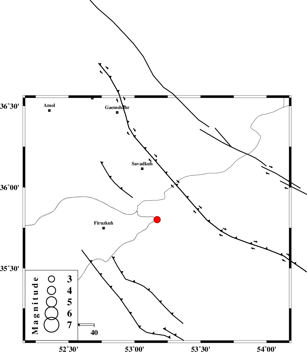
| Location | Lat:35.8 Lon: 53.17 |
| Region | Semnan Province, 36 km South-East of Pol-E-Sefid |
Nearest Cities |
|
| 13 km of Chashem, Semnan Province | |
| 15 km North West of Shahmirzad, Semnan Province | |
| 18 km North West of Mehdishahr, Semnan Province | |
| 23 km North of Aftar, Semnan Province | |
| 30 km South of Sangdeh, Mazandaran Province | |
| Depth | 14 km |
| Agency | |
Faults within 150 km: |
|
| ATARI_F (Length: 185 km) , Distance to epicenter: 15 km | |
| N_ALBORZ_F (Length: 360 km) , Distance to epicenter: 45 km | |
| MOSHA_F (Length: 234 km) , Distance to epicenter: 49 km | |
| Number of Phases | 5 |
| RMS | 0.1 |
| Number of Stations | 6 |
| Error in Latitude | >7 km |
| Error in Longitude | 7.8 km |
| Error in Depth | 7.1 km |
Download waveform in seisan format
to download seisan software Click here
to access information about IIEES stations Click here
Amplitude | ||||||||
| UID | Agency | Station | Component | Amplitude | Period | Arrival Time | Proccessing Time | Signal Clip |
| 92247 | IIEES | GHVR | E | 218.8 | 0.32 | 2014-04-19 17:27:44 | 2014-04-19 06:54:00 | n |
| 92248 | IIEES | TABS | N | 26.2 | 0.52 | 2014-04-19 17:28:51 | 2014-04-19 06:54:00 | n |
Phase | ||||||||||||
| Agency | Station | Component | Phase Type | Phase Quality | First Motion | Observed Arrival Time | Time Residual | Loc. Flag | Input Weight | Distance | Azimuth | |
| IIEES | DAMV | Z | Pg | E | 2014-04-19 17:26:48 | -0.21 | y | 110 | 260 | |||
| IIEES | GHVR | Z | Pg | E | 2014-04-19 17:27:07 | 0.13 | y | 229 | 231 | |||
| IIEES | ASAO | Z | Pn | E | 2014-04-19 17:27:17 | 0.01 | y | 319 | 245 | |||
| IIEES | YZKH | Z | Pn | E | 2014-04-19 17:27:27 | -0.06 | y | 400 | 160 | |||
| IIEES | ZNJK | Z | Pn | E | 2014-04-19 17:27:29 | 0.14 | y | 415 | 285 | |||