
Magnitude |
:4.3 |
| Date & Time (UTC) | 2014-04-01 06:37:18.0 |
| Date & Time (Local) | 1393/1/12 11:07:18.0 |
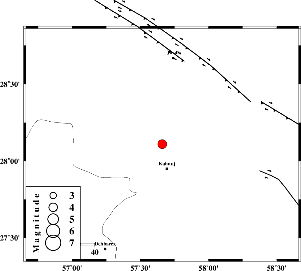
| Location | Lat:28.11 Lon: 57.66 |
| Region | Kerman Province, 18 km North of Kahnuj |
Nearest Cities |
|
| 16 km South East of Bolock, Kerman Province | |
| 18 km North of Kahnuj, Kerman Province | |
| 25 km North East of Mehrueye-e paeen, Kerman Province | |
| 35 km East of Hurpasefid, Kerman Province | |
| 39 km North East of Faryab, Kerman Province | |
| Depth | 15 km |
| Agency | |
Faults within 150 km: |
|
| SABZEVARAN_F (Length: 190 km) , Distance to epicenter: 8 km | |
| JIROFT_F (Length: 144 km) , Distance to epicenter: 13 km | |
| MAIN_ZAGROS_R_F (Length: 1106 km) , Distance to epicenter: 79 km | |
| Number of Phases | 4 |
| RMS | 0.1 |
| Number of Stations | 4 |
| Error in Latitude | >3.1 km |
| Error in Longitude | 2 km |
| Error in Depth | 0 km |
Download waveform in seisan format
to download seisan software Click here
to access information about IIEES stations Click here
Amplitude | ||||||||
| UID | Agency | Station | Component | Amplitude | Period | Arrival Time | Proccessing Time | Signal Clip |
| 92105 | IIEES | KRBR | N | 3074.4 | 0.44 | 2014-04-01 06:38:22 | 2014-04-01 08:01:00 | n |
| 92106 | IIEES | KRBR | E | 1932.1 | 0.4 | 2014-04-01 06:38:29 | 2014-04-01 08:01:00 | n |
Phase | ||||||||||||
| Agency | Station | Component | Phase Type | Phase Quality | First Motion | Observed Arrival Time | Time Residual | Loc. Flag | Input Weight | Distance | Azimuth | |
| IIEES | KRBR | Z | Pn | E | 2014-04-01 06:37:53 | 0.06 | y | 225 | 337 | |||
| IIEES | ZHSF | Z | Pn | E | 2014-04-01 06:38:08 | 0.13 | y | 347 | 61 | |||
| IIEES | CHBR | Z | Pn | E | 2014-04-01 06:38:14 | -0.04 | y | 395 | 134 | |||
| IIEES | SHRT | Z | Pn | E | 2014-04-01 06:38:47 | -0.29 | y | 664 | 22 | |||