
Magnitude |
:2.9 |
| Date & Time (UTC) | 2014-03-14 08:04:35.4 |
| Date & Time (Local) | 1392/12/23 11:34:35.4 |
| Location | Lat:31.54 Lon: 56.74 |
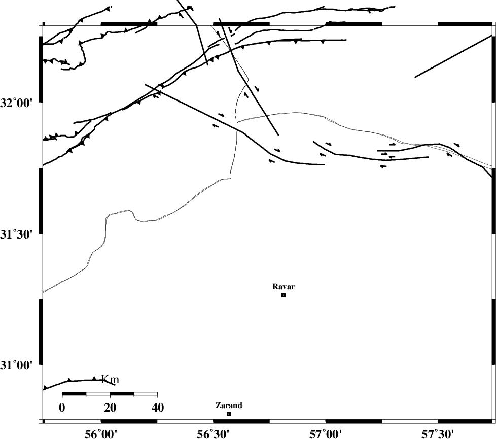
| Region | Kerman Province, 31 km North of Ravar |
Nearest Cities |
|
| 25 km North of Dehali, Kerman Province | |
| 31 km North of Ravar, Kerman Province | |
| 45 km North East of Kuhbanan, Kerman Province | |
| 47 km North East of Jor, Kerman Province | |
| 51 km South East of Asfih, Yazd Province | |
| Depth | 15 km |
| Agency | |
Faults within 150 km: |
|
| LAKARKUH_F (Length: 138 km) , Distance to epicenter: 23 km | |
| KUHBANAN_F (Length: 189 km) , Distance to epicenter: 49 km | |
| JAFARABAD_F (Length: 60 km) , Distance to epicenter: 49 km | |
| Number of Phases | 5 |
| RMS | 0.1 |
| Number of Stations | 3 |
| Error in Latitude | >1.6 km |
| Error in Longitude | 3.1 km |
| Error in Depth | 4.9 km |
Download waveform in seisan format
to download seisan software Click here
to access information about IIEES stations Click here
Amplitude | ||||||||
| UID | Agency | Station | Component | Amplitude | Period | Arrival Time | Proccessing Time | Signal Clip |
| 91995 | IIEES | KRBR | E | 159 | 0.36 | 2014-03-14 08:05:29 | 2014-03-14 09:04:00 | n |
Phase | ||||||||||||
| Agency | Station | Component | Phase Type | Phase Quality | First Motion | Observed Arrival Time | Time Residual | Loc. Flag | Input Weight | Distance | Azimuth | |
| IIEES | KRBR | Z | Pn | E | 2014-03-14 08:05:04 | 0.09 | y | 173 | 179 | |||
| IIEES | KRBR | N | Sg | E | 2014-03-14 08:05:25 | -0.04 | y | 173 | 179 | |||
| IIEES | YZKH | Z | Pn | E | 2014-03-14 08:05:11 | -0.09 | y | 224 | 295 | |||
| IIEES | YZKH | N | Sg | E | 2014-03-14 08:05:39 | 0.04 | y | 224 | 295 | |||
| IIEES | TABS | Z | Pn | E | 2014-03-14 08:05:12 | 0 | y | 236 | 9 | |||