
Magnitude |
:2.5 |
| Date & Time (UTC) | 2014-03-07 11:35:41.2 |
| Date & Time (Local) | 1392/12/16 15:05:41.2 |
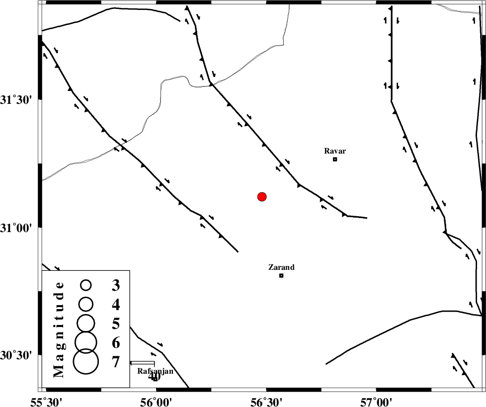
| Location | Lat:31.12 Lon: 56.48 |
| Region | Kerman Province, 35 km North of Zarand |
Nearest Cities |
|
| 7 km of Toghroljerd, Kerman Province | |
| 10 km North of Dasht-e khak, Kerman Province | |
| 19 km North West of Ahmadi, Kerman Province | |
| 33 km South East of Jor, Kerman Province | |
| 35 km North of Zarand, Kerman Province | |
| Depth | 18 km |
| Agency | |
Faults within 150 km: |
|
| KUHBANAN_F (Length: 189 km) , Distance to epicenter: 11 km | |
| DARIVAN_F (Length: 131 km) , Distance to epicenter: 53 km | |
| LAKARKUH_F (Length: 138 km) , Distance to epicenter: 64 km | |
| Number of Phases | 4 |
| RMS | 0 |
| Number of Stations | 3 |
| Error in Latitude | >2.7 km |
| Error in Longitude | 3.1 km |
| Error in Depth | 5 km |
Download waveform in seisan format
to download seisan software Click here
to access information about IIEES stations Click here
Amplitude | ||||||||
| UID | Agency | Station | Component | Amplitude | Period | Arrival Time | Proccessing Time | Signal Clip |
| 91948 | IIEES | YZKH | N | 40.6 | 0.48 | 2014-03-07 11:36:49 | 2014-03-08 03:27:00 | n |
| 91949 | IIEES | YZKH | E | 33.3 | 0.64 | 2014-03-07 11:36:50 | 2014-03-08 03:27:00 | n |
Phase | ||||||||||||
| Agency | Station | Component | Phase Type | Phase Quality | First Motion | Observed Arrival Time | Time Residual | Loc. Flag | Input Weight | Distance | Azimuth | |
| IIEES | KRBR | Z | Pg | E | 2014-03-07 11:36:03 | 0.02 | y | 129 | 168 | |||
| IIEES | YZKH | Z | Pn | E | 2014-03-07 11:36:16 | -0.08 | y | 227 | 309 | |||
| IIEES | YZKH | N | Sg | E | 2014-03-07 11:36:45 | 0.05 | y | 227 | 309 | |||
| IIEES | BSRN | Z | Pn | E | 2014-03-07 11:36:22 | 0.02 | y | 268 | 69 | |||