
Magnitude |
:3.2 |
| Date & Time (UTC) | 2014-03-03 22:12:49.2 |
| Date & Time (Local) | 1392/12/13 01:42:49.2 |
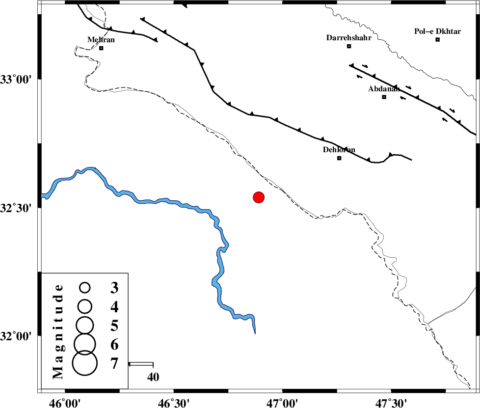
| Location | Lat:32.54 Lon: 46.89 |
| Region | Iraq, 39 km South-West of Dehloran |
Nearest Cities |
|
| 33 km South of Bishehzar, Ilam Province | |
| 39 km South West of Dehloran, Ilam Province | |
| 44 km West of Musian, Ilam Province | |
| 69 km South West of Abdanan, Ilam Province | |
| 75 km South West of Sarabbagh, Ilam Province | |
| Depth | 14 km |
| Agency | |
Faults within 150 km: |
|
| MFF6 (Length: 144 km) , Distance to epicenter: 33 km | |
| BALARUD_F_Z1 (Length: 87 km) , Distance to epicenter: 69 km | |
| ZFF4 (Length: 128 km) , Distance to epicenter: 80 km | |
| Number of Phases | 6 |
| RMS | 0 |
| Number of Stations | 5 |
| Error in Latitude | >4.4 km |
| Error in Longitude | 7.2 km |
| Error in Depth | 8 km |
Download waveform in seisan format
to download seisan software Click here
to access information about IIEES stations Click here
Amplitude | ||||||||
| UID | Agency | Station | Component | Amplitude | Period | Arrival Time | Proccessing Time | Signal Clip |
| 91916 | IIEES | SHGR | E | 290.1 | 0.48 | 2014-03-03 22:13:44 | 2014-03-03 11:16:00 | n |
| 91917 | IIEES | SHGR | N | 222.3 | 0.28 | 2014-03-03 22:13:45 | 2014-03-03 11:16:00 | n |
Phase | ||||||||||||
| Agency | Station | Component | Phase Type | Phase Quality | First Motion | Observed Arrival Time | Time Residual | Loc. Flag | Input Weight | Distance | Azimuth | |
| IIEES | SHGR | Z | Pn | E | 2014-03-03 22:13:20 | 0.01 | y | 187 | 104 | |||
| IIEES | SHGR | E | Sg | E | 2014-03-03 22:13:42 | -0.01 | y | 187 | 104 | |||
| IIEES | SNGE | Z | Pn | E | 2014-03-03 22:13:32 | -0.02 | y | 286 | 8 | |||
| IIEES | KHMZ | Z | Pn | E | 2014-03-03 22:13:36 | -0.04 | y | 316 | 64 | |||
| IIEES | ASAO | Z | Pn | E | 2014-03-03 22:13:42 | 0.07 | y | 367 | 52 | |||
| IIEES | GHVR | Z | Pn | E | 2014-03-03 22:13:53 | -0.01 | y | 458 | 61 | |||