
Magnitude |
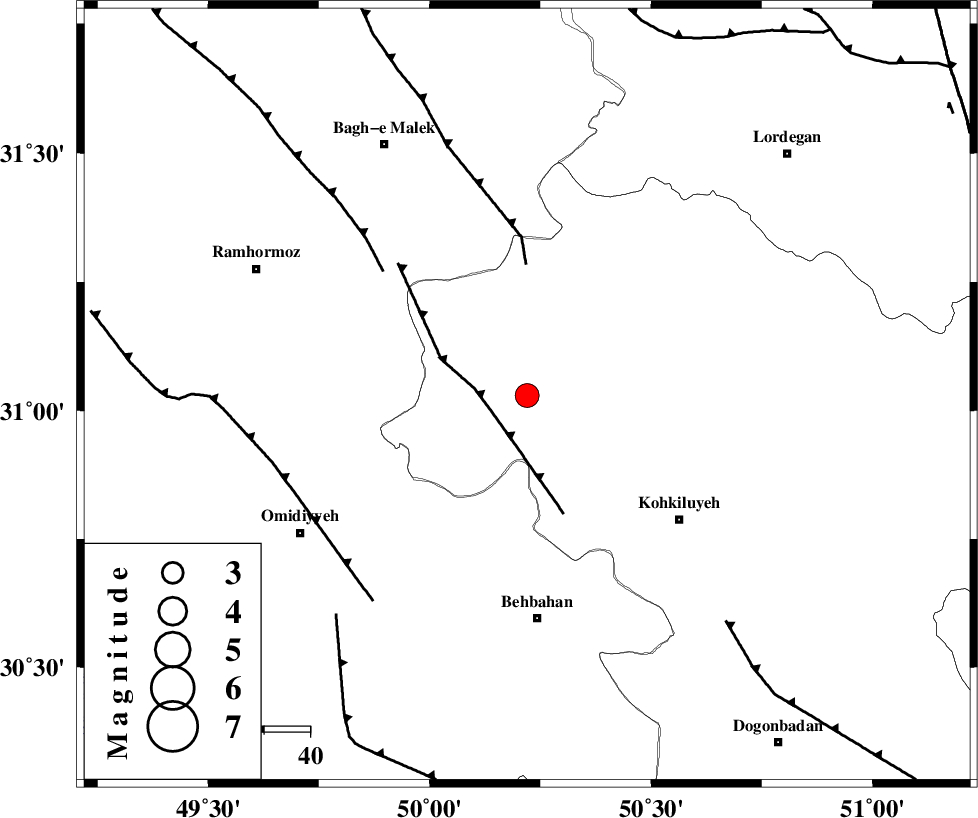
:3.4 |
| Date & Time (UTC) | 2014-01-24 16:13:55.5 |
| Date & Time (Local) | 1392/11/4 19:43:55.5 |
| Location | Lat:31.03 Lon: 50.22 |
| Region | Kohkiluieh va boyerahmad Province, 48 km North of Behbahan |
Nearest Cities |
|
| 20 km North West of Lendeh, Kohkiluieh va boyerahmad Province | |
| 27 km South West of Qale-ye raiesi, Kohkiluieh va boyerahmad Province | |
| 29 km South of Esfandan, Kohkiluieh va boyerahmad Province | |
| 34 km South West of Dishmuk, Kohkiluieh va boyerahmad Province | |
| 36 km North of Dodange-ye bozorg, Khoozestan Province | |
| Depth | 18 km |
| Agency | |
Faults within 150 km: |
|
| MFF4 (Length: 62 km) , Distance to epicenter: 8 km | |
| MFF2 (Length: 205 km) , Distance to epicenter: 28 km | |
| DEZFUL_EMBAYMENT (Length: 228 km) , Distance to epicenter: 41 km | |
| Number of Phases | 5 |
| RMS | 0 |
| Number of Stations | 4 |
| Error in Latitude | >1.4 km |
| Error in Longitude | 4.5 km |
| Error in Depth | 4.7 km |
Download waveform in seisan format
to download seisan software Click here
to access information about IIEES stations Click here
Amplitude | ||||||||
| UID | Agency | Station | Component | Amplitude | Period | Arrival Time | Proccessing Time | Signal Clip |
| 91595 | IIEES | SHGR | N | 477.5 | 0.32 | 2014-01-24 16:14:50 | 2014-01-24 04:41:00 | n |
| 91596 | IIEES | SHGR | E | 348.7 | 0.36 | 2014-01-24 16:14:52 | 2014-01-24 04:41:00 | n |
Phase | ||||||||||||
| Agency | Station | Component | Phase Type | Phase Quality | First Motion | Observed Arrival Time | Time Residual | Loc. Flag | Input Weight | Distance | Azimuth | |
| IIEES | SHGR | Z | Pg | E | 2014-01-24 16:14:25 | 0.01 | y | 180 | 312 | |||
| IIEES | AHRM | Z | Pn | E | 2014-01-24 16:14:35 | 0.02 | y | 261 | 156 | |||
| IIEES | KHMZ | Z | Pn | E | 2014-01-24 16:14:40 | -0.04 | y | 302 | 356 | |||
| IIEES | KHMZ | N | Sg | E | 2014-01-24 16:15:20 | 0.03 | y | 302 | 356 | |||
| IIEES | ASAO | Z | Pn | E | 2014-01-24 16:14:51 | -0.02 | y | 391 | 357 | |||