
Magnitude |
:2.2 |
| Date & Time (UTC) | 2014-01-21 21:46:46.7 |
| Date & Time (Local) | 1392/11/2 01:16:46.7 |
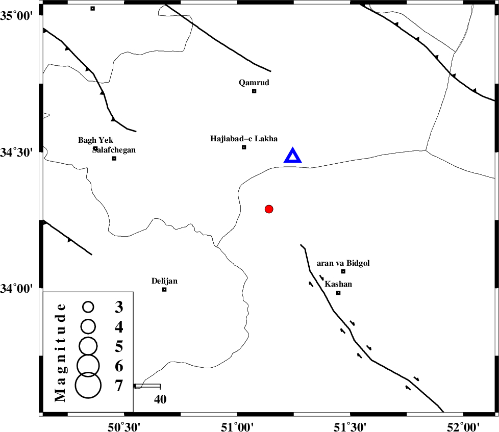
| Location | Lat:34.29 Lon: 51.14 |
| Region | Esfahan Province, 39 km North-West of Aran va bidgol |
Nearest Cities |
|
| 13 km North East of Yahyaabad, Esfahan Province | |
| 17 km North West of Mashgan, Esfahan Province | |
| 21 km North of Armak, Esfahan Province | |
| 26 km North West of Nasrabad, Esfahan Province | |
| 27 km East of Kahak, Qom Province | |
| Depth | 27 km |
| Agency | |
Faults within 150 km: |
|
| KASHAN_F (Length: 44 km) , Distance to epicenter: 19 km | |
| KUSHK_E_NOSRAT_F (Length: 230 km) , Distance to epicenter: 56 km | |
| INDES_F (Length: 98 km) , Distance to epicenter: 62 km | |
| Number of Phases | 6 |
| RMS | 0.2 |
| Number of Stations | 3 |
| Error in Latitude | >3.2 km |
| Error in Longitude | 4 km |
| Error in Depth | 7.5 km |
Download waveform in seisan format
to download seisan software Click here
to access information about IIEES stations Click here
Amplitude | ||||||||
| UID | Agency | Station | Component | Amplitude | Period | Arrival Time | Proccessing Time | Signal Clip |
| 91568 | IIEES | GHVR | N | 376.6 | 0.32 | 2014-01-21 21:46:57 | 2014-01-22 03:37:00 | n |
| 91569 | IIEES | GHVR | E | 244.7 | 0.12 | 2014-01-21 21:46:58 | 2014-01-22 03:37:00 | n |
Phase | ||||||||||||
| Agency | Station | Component | Phase Type | Phase Quality | First Motion | Observed Arrival Time | Time Residual | Loc. Flag | Input Weight | Distance | Azimuth | |
| IIEES | GHVR | Z | Pg | E | 2014-01-21 21:46:52 | 0.08 | y | 23.1 | 25 | |||
| IIEES | GHVR | N | Sg | E | 2014-01-21 21:46:56 | -0.05 | y | 23.1 | 25 | |||
| IIEES | ASAO | Z | Pg | E | 2014-01-21 21:47:04 | 0.2 | y | 106 | 286 | |||
| IIEES | ASAO | E | Sg | E | 2014-01-21 21:47:17 | -0.12 | y | 106 | 286 | |||
| IIEES | KHMZ | Z | Pg | E | 2014-01-21 21:47:07 | -0.29 | y | 125 | 241 | |||
| IIEES | KHMZ | E | Sg | E | 2014-01-21 21:47:22 | 0.17 | y | 125 | 241 | |||