
Magnitude |
:3.6 |
| Date & Time (UTC) | 2014-01-18 12:00:20.3 |
| Date & Time (Local) | 1392/10/28 15:30:20.3 |
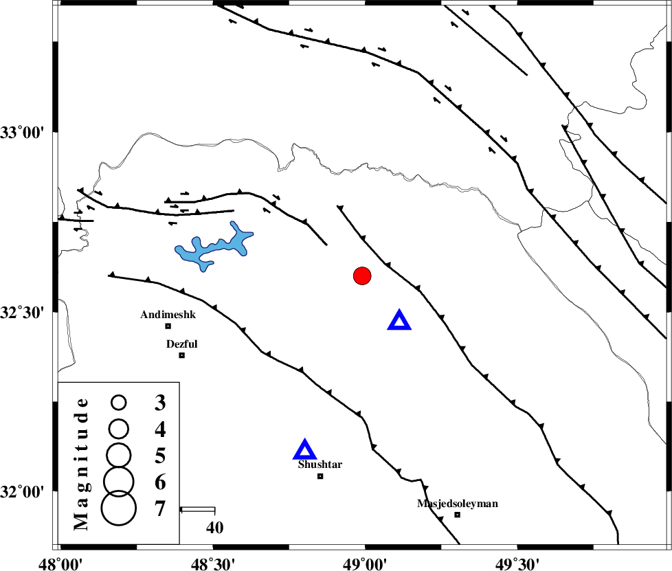
| Location | Lat:32.6 Lon: 48.99 |
| Region | Khoozestan Province, 25 km North-West of Lali |
Nearest Cities |
|
| 18 km North East of Sardasht, Khoozestan Province | |
| 26 km North West of Lali, Khoozestan Province | |
| 28 km South East of Shuy, Khoozestan Province | |
| 38 km North East of Mahur berenji, Khoozestan Province | |
| 39 km North West of Jaefarabad, Khoozestan Province | |
| Depth | 16 km |
| Agency | |
Faults within 150 km: |
|
| MFF2 (Length: 205 km) , Distance to epicenter: 8 km | |
| BALARUD_F_Z2 (Length: 58 km) , Distance to epicenter: 14 km | |
| DEZFUL_EMBAYMENT (Length: 228 km) , Distance to epicenter: 35 km | |
| Number of Phases | 6 |
| RMS | 0.2 |
| Number of Stations | 4 |
| Error in Latitude | >2.2 km |
| Error in Longitude | 5.3 km |
| Error in Depth | 4.3 km |
Download waveform in seisan format
to download seisan software Click here
to access information about IIEES stations Click here
Amplitude | ||||||||
| UID | Agency | Station | Component | Amplitude | Period | Arrival Time | Proccessing Time | Signal Clip |
| 91527 | IIEES | SHGR | E | 2988.4 | 0.52 | 2014-01-18 12:00:43 | 2014-01-18 12:29:00 | n |
| 91528 | IIEES | SHGR | N | 6378.9 | 0.88 | 2014-01-18 12:00:47 | 2014-01-18 12:29:00 | n |
Phase | ||||||||||||
| Agency | Station | Component | Phase Type | Phase Quality | First Motion | Observed Arrival Time | Time Residual | Loc. Flag | Input Weight | Distance | Azimuth | |
| IIEES | SHGR | Z | Pg | E | 2014-01-18 12:00:30 | -0.27 | y | 57.1 | 199 | |||
| IIEES | SHGR | E | Sg | E | 2014-01-18 12:00:38 | 0.21 | y | 57.1 | 199 | |||
| IIEES | ASAO | Z | Pn | E | 2014-01-18 12:00:57 | 0.12 | y | 237 | 24 | |||
| IIEES | ASAO | N | Sg | E | 2014-01-18 12:01:27 | 0.04 | y | 237 | 24 | |||
| IIEES | GHVR | Z | Pn | E | 2014-01-18 12:01:04 | -0.09 | y | 296 | 44 | |||
| IIEES | SNGE | Z | Pn | E | 2014-01-18 12:01:07 | -0.03 | y | 316 | 332 | |||