
Magnitude |
:3.2 |
| Date & Time (UTC) | 2014-01-03 19:03:42.1 |
| Date & Time (Local) | 1392/10/13 22:33:42.1 |
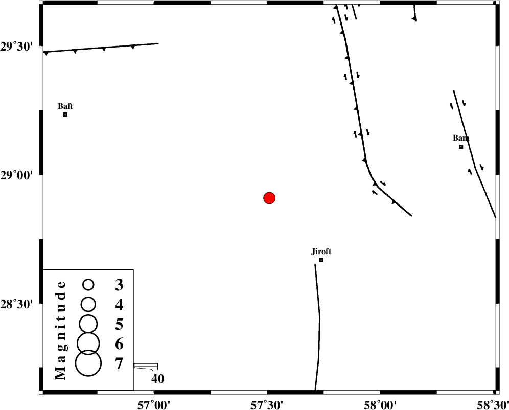
| Location | Lat:28.91 Lon: 57.51 |
| Region | Kerman Province, 35 km North-West of Jiroft |
Nearest Cities |
|
| 13 km of Delfard, Kerman Province | |
| 16 km South of Sahebabad, Kerman Province | |
| 20 km East of Eslamabad, Kerman Province | |
| 35 km North West of Jiroft, Kerman Province | |
| 38 km North West of Saghdar, Kerman Province | |
| Depth | 14 km |
| Agency | |
Faults within 150 km: |
|
| SABZEVARAN_F (Length: 190 km) , Distance to epicenter: 35 km | |
| GOWK_F (Length: 152 km) , Distance to epicenter: 44 km | |
| LALEHZAR_F (Length: 52 km) , Distance to epicenter: 82 km | |
| Number of Phases | 6 |
| RMS | 0.2 |
| Number of Stations | 4 |
| Error in Latitude | >1.8 km |
| Error in Longitude | 7.6 km |
| Error in Depth | 9 km |
Download waveform in seisan format
to download seisan software Click here
to access information about IIEES stations Click here
Amplitude | ||||||||
| UID | Agency | Station | Component | Amplitude | Period | Arrival Time | Proccessing Time | Signal Clip |
| 91370 | IIEES | KRBR | E | 459.3 | 0.16 | 2014-01-03 19:04:25 | 2014-01-03 07:29:00 | n |
| 91371 | IIEES | KRBR | N | 361 | 0.32 | 2014-01-03 19:04:25 | 2014-01-03 07:29:00 | n |
| 91372 | IIEES | BNDS | E | 197.2 | 0.52 | 2014-01-03 19:04:43 | 2014-01-03 07:29:00 | n |
Phase | ||||||||||||
| Agency | Station | Component | Phase Type | Phase Quality | First Motion | Observed Arrival Time | Time Residual | Loc. Flag | Input Weight | Distance | Azimuth | |
| IIEES | KRBR | Z | Pg | E | 2014-01-03 19:04:05 | -0.24 | y | 139 | 329 | |||
| IIEES | KRBR | E | Sg | E | 2014-01-03 19:04:22 | 0.17 | y | 139 | 329 | |||
| IIEES | BNDS | Z | Pn | E | 2014-01-03 19:04:16 | 0.26 | y | 213 | 218 | |||
| IIEES | BNDS | E | Sg | E | 2014-01-03 19:04:42 | -0.13 | y | 213 | 218 | |||
| IIEES | TABS | Z | Pn | E | 2014-01-03 19:04:55 | -0.17 | y | 527 | 356 | |||
| IIEES | SHRT | Z | Pn | E | 2014-01-03 19:05:03 | 0.07 | y | 588 | 26 | |||