
Magnitude |
:3.4 |
| Date & Time (UTC) | 2013-03-09 03:25:01.3 |
| Date & Time (Local) | 1391/12/19 06:55:01.3 |
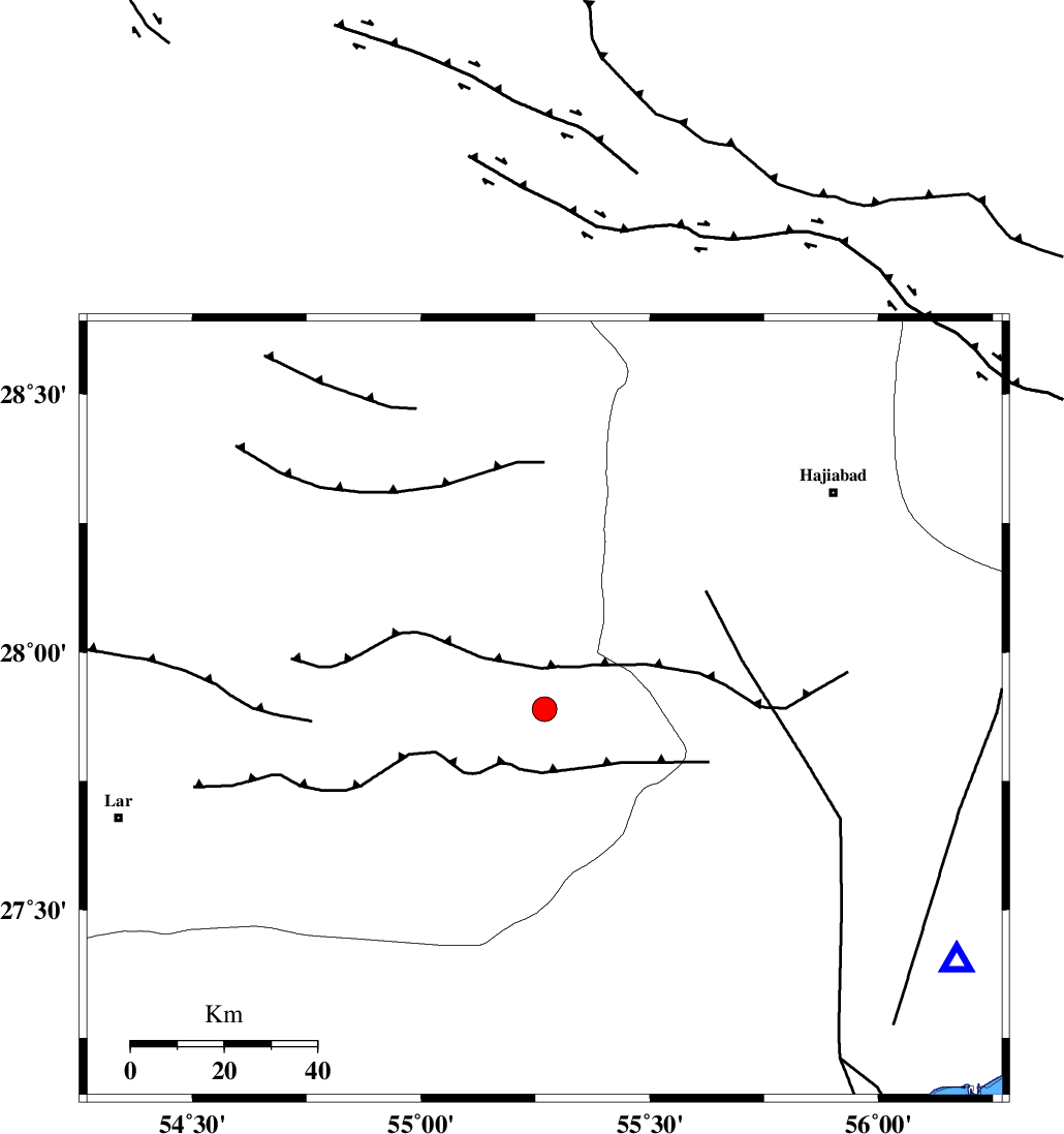
| Location | Lat:27.89 Lon: 55.27 |
| Region | Fars Province, 78 km South-West of Hajiabad |
Nearest Cities |
|
| 15 km North West of Darz, Fars Province | |
| 36 km South of Fadami, Fars Province | |
| 47 km South of Doborji, Fars Province | |
| 65 km South East of Rostaq, Fars Province | |
| 68 km North West of Fin, Hormozgan Province | |
| Depth | 18 km |
| Agency | |
Faults within 150 km: |
|
| HZF2 (Length: 437 km) , Distance to epicenter: 38 km | |
| LAR_F (Length: 99 km) , Distance to epicenter: 53 km | |
| HZF1 (Length: 102 km) , Distance to epicenter: 59 km | |
| Number of Phases | 5 |
| RMS | 0 |
| Number of Stations | 3 |
| Error in Latitude | >8.6 km |
| Error in Longitude | 4.4 km |
| Error in Depth | 7.3 km |
Download waveform in seisan format
to download seisan software Click here
to access information about IIEES stations Click here
Amplitude | ||||||||
| UID | Agency | Station | Component | Amplitude | Period | Arrival Time | Proccessing Time | Signal Clip |
| 88146 | IIEES | GHIR | E | 279 | 0.52 | 2013-03-09 03:26:09 | 2013-03-09 03:54:00 | n |
| 88147 | IIEES | GHIR | N | 257.3 | 0.48 | 2013-03-09 03:26:18 | 2013-03-09 03:54:00 | n |
| 88148 | IIEES | KRBR | E | 146.9 | 0.56 | 2013-03-09 03:26:31 | 2013-03-09 03:54:00 | n |
Phase | ||||||||||||
| Agency | Station | Component | Phase Type | Phase Quality | First Motion | Observed Arrival Time | Time Residual | Loc. Flag | Input Weight | Distance | Azimuth | |
| IIEES | GHIR | Z | Pn | E | 2013-03-09 03:25:37 | 0.04 | y | 229 | 282 | |||
| IIEES | GHIR | N | Sg | E | 2013-03-09 03:26:06 | -0.02 | y | 229 | 282 | |||
| IIEES | KRBR | Z | Pn | E | 2013-03-09 03:25:42 | -0.01 | y | 274 | 32 | |||
| IIEES | KRBR | E | Sg | E | 2013-03-09 03:26:18 | 0.02 | y | 274 | 32 | |||
| IIEES | YZKH | Z | Pn | E | 2013-03-09 03:26:11 | -0.05 | y | 503 | 353 | |||