
Magnitude |
:2.8 |
| Date & Time (UTC) | 2013-02-23 21:16:08.9 |
| Date & Time (Local) | 1391/12/6 00:46:08.9 |
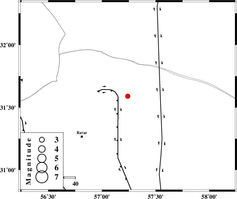
| Location | Lat:31.59 Lon: 57.24 |
| Region | Kerman Province, 54 km North-East of Ravar |
Nearest Cities |
|
| 51 km North East of Dehali, Kerman Province | |
| 54 km North East of Ravar, Kerman Province | |
| 66 km South West of Hoz-e qorban, Yazd Province | |
| 87 km North East of Ahmadi, Kerman Province | |
| 87 km North East of Dasht-e khak, Kerman Province | |
| Depth | 16 km |
| Agency | |
Faults within 150 km: |
|
| LAKARKUH_F (Length: 138 km) , Distance to epicenter: 9 km | |
| NAYBAND_F (Length: 258 km) , Distance to epicenter: 31 km | |
| JAFARABAD_F (Length: 60 km) , Distance to epicenter: 94 km | |
| Number of Phases | 5 |
| RMS | 0.1 |
| Number of Stations | 3 |
| Error in Latitude | >0.9 km |
| Error in Longitude | 5 km |
| Error in Depth | 3.2 km |
Download waveform in seisan format
to download seisan software Click here
to access information about IIEES stations Click here
Amplitude | ||||||||
| UID | Agency | Station | Component | Amplitude | Period | Arrival Time | Proccessing Time | Signal Clip |
| 88007 | IIEES | KRBR | N | 72.7 | 0.2 | 2013-02-23 21:17:03 | 2013-02-24 12:01:00 | n |
| 88008 | IIEES | KRBR | E | 134.8 | 0.28 | 2013-02-23 21:17:08 | 2013-02-24 12:01:00 | n |
Phase | ||||||||||||
| Agency | Station | Component | Phase Type | Phase Quality | First Motion | Observed Arrival Time | Time Residual | Loc. Flag | Input Weight | Distance | Azimuth | |
| IIEES | KRBR | Z | Pn | E | 2013-02-23 21:16:39 | -0.1 | y | 184 | 195 | |||
| IIEES | KRBR | N | Sg | E | 2013-02-23 21:17:01 | 0.04 | y | 184 | 195 | |||
| IIEES | TABS | Z | Pn | E | 2013-02-23 21:16:45 | 0.1 | y | 229 | 357 | |||
| IIEES | TABS | N | Sg | E | 2013-02-23 21:17:13 | -0.04 | y | 229 | 357 | |||
| IIEES | YZKH | Z | Pn | E | 2013-02-23 21:16:49 | 0 | y | 266 | 290 | |||