
Magnitude |
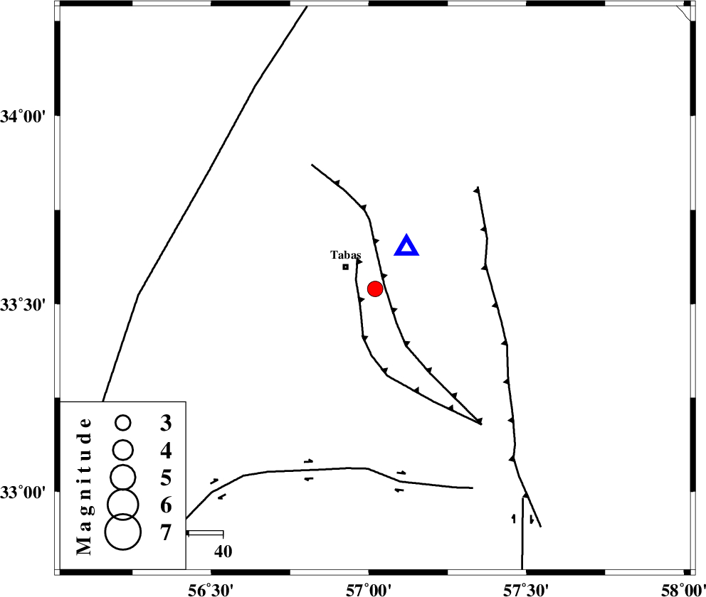
:3.1 |
| Date & Time (UTC) | 2013-01-08 13:35:07.2 |
| Date & Time (Local) | 1391/10/19 17:05:07.2 |
| Location | Lat:33.54 Lon: 57.02 |
| Region | Yazd Province, 10 km Tabas |
Nearest Cities |
|
| 10 km East of Oshtoqran, Yazd Province | |
| 11 km of Tabas, Yazd Province | |
| 13 km North of Kerit, Yazd Province | |
| 30 km South East of Jokhvah, Yazd Province | |
| 38 km South West of Reqqeh, Khorasan(center) Province | |
| Depth | 14 km |
| Agency | |
Faults within 150 km: |
|
| TABAS_F1 (Length: 91 km) , Distance to epicenter: 3 km | |
| TABAS_F2 (Length: 67 km) , Distance to epicenter: 6 km | |
| ESFARDIAR_F (Length: 94 km) , Distance to epicenter: 33 km | |
| Number of Phases | 4 |
| RMS | 0 |
| Number of Stations | 3 |
| Error in Latitude | >8.2 km |
| Error in Longitude | 5.1 km |
| Error in Depth | 4 km |
Download waveform in seisan format
to download seisan software Click here
to access information about IIEES stations Click here
Amplitude | ||||||||
| UID | Agency | Station | Component | Amplitude | Period | Arrival Time | Proccessing Time | Signal Clip |
| 87559 | IIEES | YZKH | N | 86.7 | 0.32 | 2013-01-08 13:36:19 | 2013-01-08 02:31:00 | n |
| 87560 | IIEES | YZKH | E | 99 | 0.56 | 2013-01-08 13:36:27 | 2013-01-08 02:31:00 | n |
Phase | ||||||||||||
| Agency | Station | Component | Phase Type | Phase Quality | First Motion | Observed Arrival Time | Time Residual | Loc. Flag | Input Weight | Distance | Azimuth | |
| IIEES | TABS | Z | Pg | E | 2013-01-08 13:35:11 | -0.01 | y | 15.3 | 39 | |||
| IIEES | YZKH | Z | Pn | E | 2013-01-08 13:35:47 | 0.01 | y | 260 | 241 | |||
| IIEES | YZKH | N | Sg | E | 2013-01-08 13:36:20 | 0 | y | 260 | 241 | |||
| IIEES | SHRT | Z | Pn | E | 2013-01-08 13:35:52 | 0 | y | 304 | 87 | |||