
Magnitude |
:3.1 |
| Date & Time (UTC) | 2012-12-05 13:15:48.2 |
| Date & Time (Local) | 1391/9/15 16:45:48.2 |
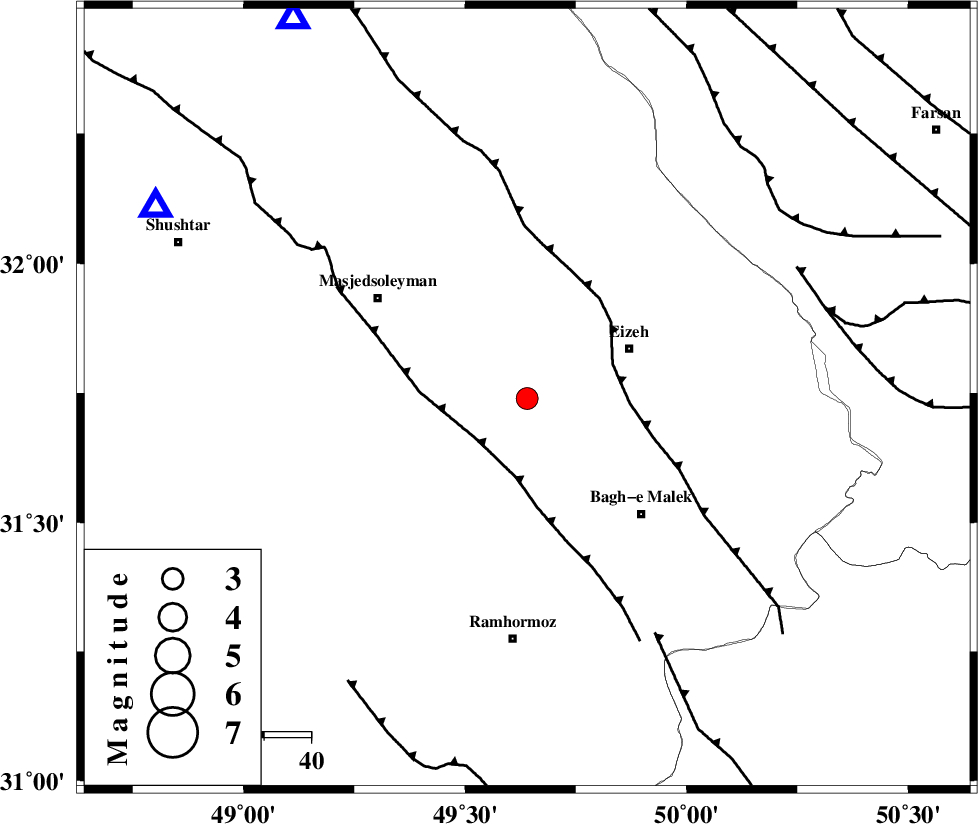
| Location | Lat:31.74 Lon: 49.64 |
| Region | Khoozestan Province, 24 km West of Izeh |
Nearest Cities |
|
| 14 km West of Chenarestan, Khoozestan Province | |
| 21 km South West of Rasvand, Khoozestan Province | |
| 23 km North of Jaru, Khoozestan Province | |
| 24 km West of Izeh, Khoozestan Province | |
| 27 km North West of Ghaleh tal, Khoozestan Province | |
| Depth | 18 km |
| Agency | |
Faults within 150 km: |
|
| DEZFUL_EMBAYMENT (Length: 228 km) , Distance to epicenter: 14 km | |
| MFF2 (Length: 205 km) , Distance to epicenter: 20 km | |
| MFF4 (Length: 62 km) , Distance to epicenter: 57 km | |
| Number of Phases | 4 |
| RMS | 0 |
| Number of Stations | 3 |
| Error in Latitude | >2.7 km |
| Error in Longitude | 3.6 km |
| Error in Depth | 5.9 km |
Download waveform in seisan format
to download seisan software Click here
to access information about IIEES stations Click here
Amplitude | ||||||||
| UID | Agency | Station | Component | Amplitude | Period | Arrival Time | Proccessing Time | Signal Clip |
| 87269 | IIEES | SHGR | N | 852.7 | 0.24 | 2012-12-05 13:16:18 | 2012-12-05 02:05:00 | n |
| 87270 | IIEES | SHGR | E | 1063.7 | 0.2 | 2012-12-05 13:16:18 | 2012-12-05 02:05:00 | n |
| 87271 | IIEES | KHMZ | E | 66.5 | 0.52 | 2012-12-05 13:17:02 | 2012-12-05 02:05:00 | n |
Phase | ||||||||||||
| Agency | Station | Component | Phase Type | Phase Quality | First Motion | Observed Arrival Time | Time Residual | Loc. Flag | Input Weight | Distance | Azimuth | |
| IIEES | SHGR | Z | Pg | E | 2012-12-05 13:16:03 | 0.01 | y | 89.6 | 298 | |||
| IIEES | KHMZ | Z | Pn | E | 2012-12-05 13:16:23 | -0.05 | y | 224 | 8 | |||
| IIEES | KHMZ | E | Sg | E | 2012-12-05 13:16:52 | 0.02 | y | 224 | 8 | |||
| IIEES | YZKH | Z | Pn | E | 2012-12-05 13:16:54 | 0.02 | y | 473 | 80 | |||