
Magnitude |
:2.8 |
| Date & Time (UTC) | 2012-12-04 01:18:33.0 |
| Date & Time (Local) | 1391/9/14 04:48:33.0 |
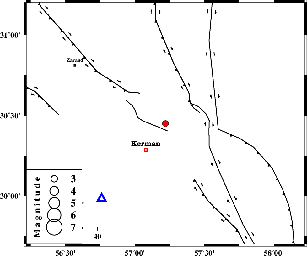
| Location | Lat:30.45 Lon: 57.22 |
| Region | Kerman Province, 23 km North-East of Kerman |
Nearest Cities |
|
| 8 km of Dehlulu, Kerman Province | |
| 21 km North of Sarasiyab-e ferangi, Kerman Province | |
| 23 km North East of Kerman, Kerman Province | |
| 24 km South of Harjand, Kerman Province | |
| 30 km North East of Zangiabad, Kerman Province | |
| Depth | 14 km |
| Agency | |
Faults within 150 km: |
|
| CHATRUD_F (Length: 37 km) , Distance to epicenter: 5 km | |
| GOLBAF_SIRCH_F (Length: 114 km) , Distance to epicenter: 22 km | |
| LAKARKUH_F (Length: 138 km) , Distance to epicenter: 22 km | |
| Number of Phases | 5 |
| RMS | 0.2 |
| Number of Stations | 4 |
| Error in Latitude | >2.8 km |
| Error in Longitude | 5.2 km |
| Error in Depth | 9.1 km |
Download waveform in seisan format
to download seisan software Click here
to access information about IIEES stations Click here
Amplitude | ||||||||
| UID | Agency | Station | Component | Amplitude | Period | Arrival Time | Proccessing Time | Signal Clip |
| 87260 | IIEES | TABS | N | 25.9 | 0.52 | 2012-12-04 01:20:18 | 2012-12-04 01:47:00 | n |
Phase | ||||||||||||
| Agency | Station | Component | Phase Type | Phase Quality | First Motion | Observed Arrival Time | Time Residual | Loc. Flag | Input Weight | Distance | Azimuth | |
| IIEES | KRBR | Z | Pg | E | 2012-12-04 01:18:45 | -0.03 | y | 68.7 | 221 | |||
| IIEES | YZKH | Z | Pn | E | 2012-12-04 01:19:21 | 0.12 | y | 330 | 311 | |||
| IIEES | YZKH | N | Sg | E | 2012-12-04 01:20:05 | 0.03 | y | 330 | 311 | |||
| IIEES | TABS | Z | Pn | E | 2012-12-04 01:19:24 | -0.31 | y | 355 | 358 | |||
| IIEES | SHRT | Z | Pn | E | 2012-12-04 01:19:37 | 0.22 | y | 457 | 38 | |||