
Magnitude |
:3.4 |
| Date & Time (UTC) | 2012-11-24 21:39:08.5 |
| Date & Time (Local) | 1391/9/5 01:09:08.5 |
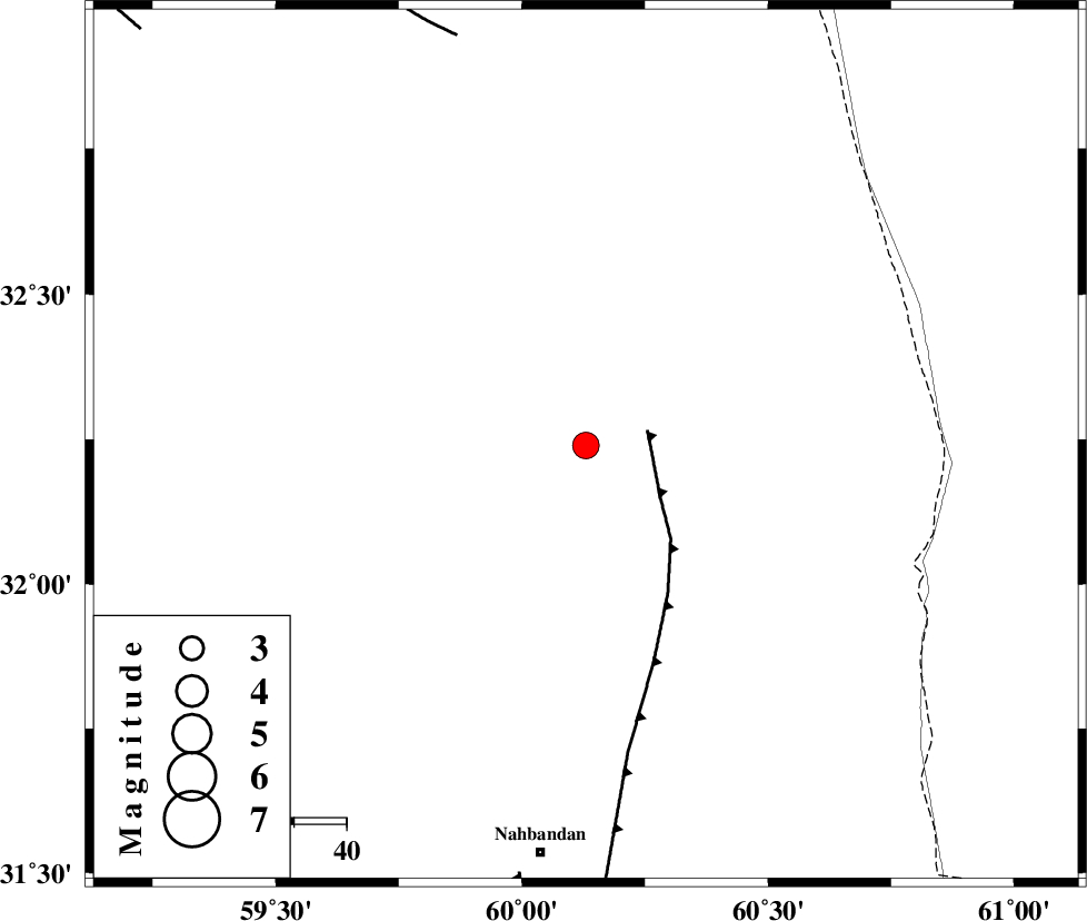
| Location | Lat:32.24 Lon: 60.13 |
| Region | Khorasan(south) Province, 53 km South-East of Sarbisheh |
Nearest Cities |
|
| 36 km North East of Shusef, Khorasan(south) Province | |
| 43 km South West of Dorj, Khorasan(south) Province | |
| 48 km South East of Salmabad, Khorasan(south) Province | |
| 53 km South East of Sarbisheh, Khorasan(south) Province | |
| 64 km South of Tabas masina, Khorasan(south) Province | |
| Depth | 17 km |
| Agency | |
Faults within 150 km: |
|
| E_NEH_F (Length: 148 km) , Distance to epicenter: 12 km | |
| NOZAD_F (Length: 27 km) , Distance to epicenter: 82 km | |
| W_NEH_F (Length: 158 km) , Distance to epicenter: 83 km | |
| Number of Phases | 5 |
| RMS | 0 |
| Number of Stations | 4 |
| Error in Latitude | >3.4 km |
| Error in Longitude | 2.8 km |
| Error in Depth | 4.5 km |
Download waveform in seisan format
to download seisan software Click here
to access information about IIEES stations Click here
Amplitude | ||||||||
| UID | Agency | Station | Component | Amplitude | Period | Arrival Time | Proccessing Time | Signal Clip |
| 87145 | IIEES | SHRT | E | 446 | 0.44 | 2012-11-24 21:39:59 | 2012-11-24 09:06:00 | n |
| 87146 | IIEES | KRBR | N | 70.2 | 0.52 | 2012-11-24 21:41:09 | 2012-11-24 09:06:00 | n |
| 87147 | IIEES | KRBR | E | 69 | 0.8 | 2012-11-24 21:41:11 | 2012-11-24 09:06:00 | n |
Phase | ||||||||||||
| Agency | Station | Component | Phase Type | Phase Quality | First Motion | Observed Arrival Time | Time Residual | Loc. Flag | Input Weight | Distance | Azimuth | |
| IIEES | SHRT | Z | Pg | E | 2012-11-24 21:39:34 | 0 | y | 157 | 6 | |||
| IIEES | TABS | Z | Pn | E | 2012-11-24 21:39:55 | -0.03 | y | 322 | 300 | |||
| IIEES | KRBR | Z | Pn | E | 2012-11-24 21:40:06 | -0.02 | y | 407 | 233 | |||
| IIEES | YZKH | Z | Pn | E | 2012-11-24 21:40:20 | 0.06 | y | 521 | 273 | |||
| IIEES | YZKH | N | Sg | E | 2012-11-24 21:41:33 | 0 | y | 521 | 273 | |||