
Magnitude |
:3.7 |
| Date & Time (UTC) | 2012-11-19 14:11:24.8 |
| Date & Time (Local) | 1391/8/29 17:41:24.8 |
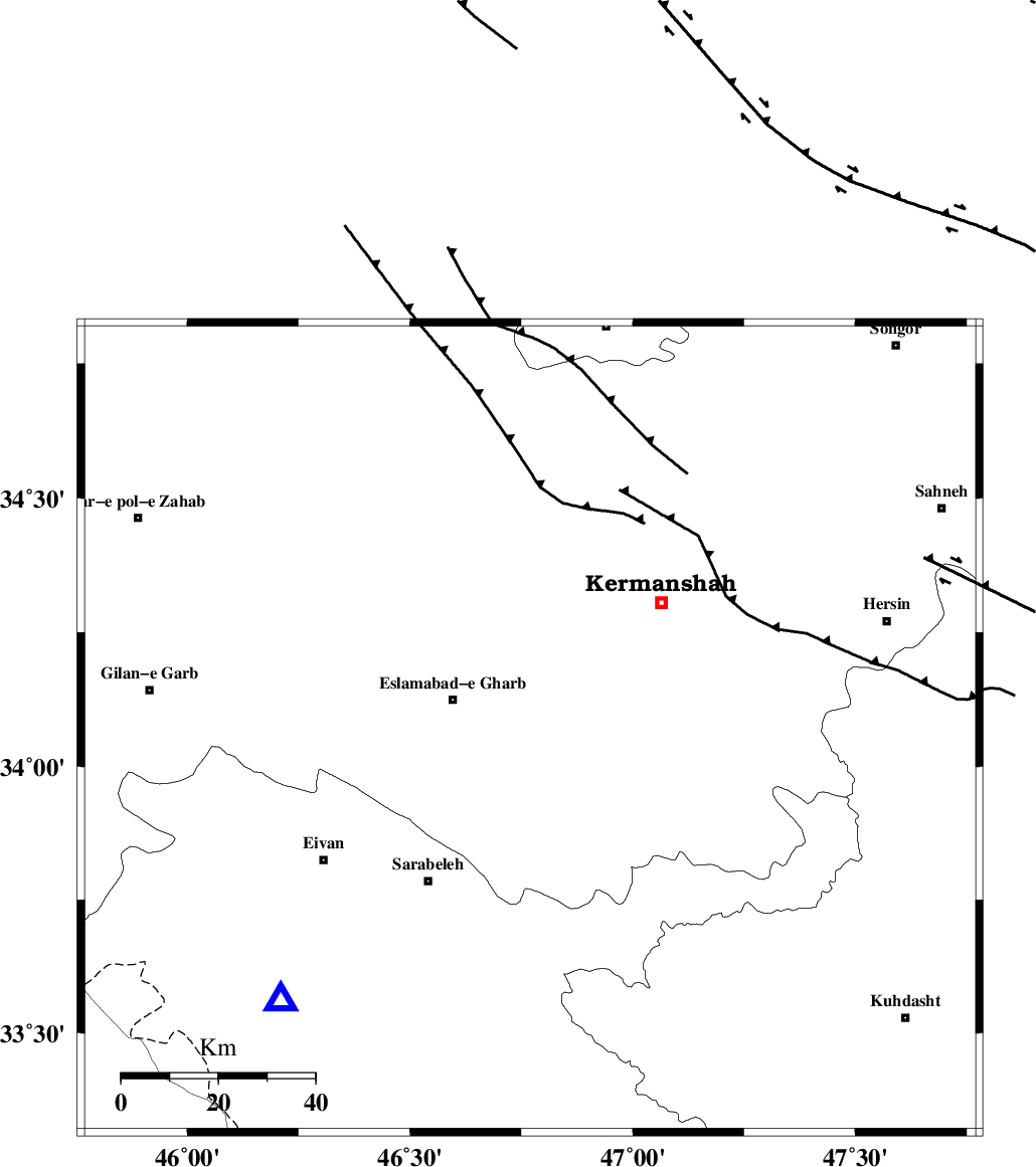
| Location | Lat:34.07 Lon: 46.77 |
| Region | Kermanshah Province, 16 km East of Eslam Abad-E-Gharb |
Nearest Cities |
|
| 6 km North of Qale-ye shahin, Kermanshah Province | |
| 15 km North of Hamil, Kermanshah Province | |
| 17 km East of Eslam Abad-E-Gharb, Kermanshah Province | |
| 19 km South East of Hasanabad, Kermanshah Province | |
| 20 km South West of Helshi, Kermanshah Province | |
| Depth | 37 km |
| Agency | |
Faults within 150 km: |
|
| HZF4 (Length: 492 km) , Distance to epicenter: 15 km | |
| MFF7 (Length: 99 km) , Distance to epicenter: 77 km | |
| MFF8 (Length: 48 km) , Distance to epicenter: 78 km | |
| Number of Phases | 6 |
| RMS | 0.1 |
| Number of Stations | 3 |
| Error in Latitude | >1.5 km |
| Error in Longitude | 3.5 km |
| Error in Depth | 3.4 km |
Download waveform in seisan format
to download seisan software Click here
to access information about IIEES stations Click here
Amplitude | ||||||||
| UID | Agency | Station | Component | Amplitude | Period | Arrival Time | Proccessing Time | Signal Clip |
| 87090 | IIEES | SNGE | N | 913.8 | 0.4 | 2012-11-19 14:12:08 | 2012-11-19 01:41:00 | n |
| 87091 | IIEES | SNGE | E | 1840.6 | 0.56 | 2012-11-19 14:12:09 | 2012-11-19 01:41:00 | n |
| 87092 | IIEES | SHGR | N | 322.9 | 0.36 | 2012-11-19 14:12:57 | 2012-11-19 01:41:00 | n |
| 87093 | IIEES | SHGR | E | 315.2 | 0.56 | 2012-11-19 14:13:03 | 2012-11-19 01:41:00 | n |
Phase | ||||||||||||
| Agency | Station | Component | Phase Type | Phase Quality | First Motion | Observed Arrival Time | Time Residual | Loc. Flag | Input Weight | Distance | Azimuth | |
| IIEES | SNGE | Z | Pg | E | 2012-11-19 14:11:45 | 0.04 | y | 125 | 25 | |||
| IIEES | SNGE | N | Sg | E | 2012-11-19 14:12:01 | -0.04 | y | 125 | 25 | |||
| IIEES | SHGR | Z | Pn | E | 2012-11-19 14:12:06 | -0.15 | y | 289 | 138 | |||
| IIEES | SHGR | N | Sg | E | 2012-11-19 14:12:44 | 0.05 | y | 289 | 138 | |||
| IIEES | KHMZ | Z | Pn | E | 2012-11-19 14:12:07 | 0.14 | y | 298 | 96 | |||
| IIEES | KHMZ | N | Sg | E | 2012-11-19 14:12:46 | -0.05 | y | 298 | 96 | |||