
Magnitude |
:3.6 |
| Date & Time (UTC) | 2012-11-19 02:51:25.8 |
| Date & Time (Local) | 1391/8/29 06:21:25.8 |
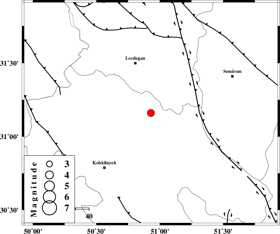
| Location | Lat:31.16 Lon: 50.93 |
| Region | Kohkiluieh va boyerahmad Province, 40 km South-East of Lordegan |
Nearest Cities |
|
| 23 km North West of Margun, Kohkiluieh va boyerahmad Province | |
| 24 km North West of Dezhak, Kohkiluieh va boyerahmad Province | |
| 25 km South of Sardasht, Chaharmahal Bakhtiari Province | |
| 31 km South East of Pataveh, Kohkiluieh va boyerahmad Province | |
| 32 km North West of Meymand, Kohkiluieh va boyerahmad Province | |
| Depth | 16 km |
| Agency | |
Faults within 150 km: |
|
| DENA_F (Length: 137 km) , Distance to epicenter: 37 km | |
| DOPOLAN_F (Length: 107 km) , Distance to epicenter: 58 km | |
| SABZKUH_F (Length: 67 km) , Distance to epicenter: 64 km | |
| Number of Phases | 8 |
| RMS | 0.1 |
| Number of Stations | 6 |
| Error in Latitude | >1.3 km |
| Error in Longitude | 1.9 km |
| Error in Depth | 3.7 km |
Download waveform in seisan format
to download seisan software Click here
to access information about IIEES stations Click here
Amplitude | ||||||||
| UID | Agency | Station | Component | Amplitude | Period | Arrival Time | Proccessing Time | Signal Clip |
| 87076 | IIEES | SHGR | E | 558.9 | 0.56 | 2012-11-19 02:52:46 | 2012-11-19 02:19:00 | n |
| 87077 | IIEES | SHGR | N | 379.6 | 0.56 | 2012-11-19 02:52:50 | 2012-11-19 02:19:00 | n |
| 87078 | IIEES | AHRM | E | 376.1 | 0.4 | 2012-11-19 02:52:44 | 2012-11-19 02:19:00 | n |
| 87079 | IIEES | AHRM | N | 290.8 | 0.56 | 2012-11-19 02:52:49 | 2012-11-19 02:19:00 | n |
Phase | ||||||||||||
| Agency | Station | Component | Phase Type | Phase Quality | First Motion | Observed Arrival Time | Time Residual | Loc. Flag | Input Weight | Distance | Azimuth | |
| IIEES | SHGR | Z | Pn | E | 2012-11-19 02:52:01 | -0.08 | y | 228 | 298 | |||
| IIEES | SHGR | E | Sg | E | 2012-11-19 02:52:30 | 0.08 | y | 228 | 298 | |||
| IIEES | AHRM | Z | Pn | E | 2012-11-19 02:52:05 | 0.08 | y | 256 | 172 | |||
| IIEES | AHRM | E | Sg | E | 2012-11-19 02:52:38 | -0.08 | y | 256 | 172 | |||
| IIEES | KHMZ | Z | Pn | E | 2012-11-19 02:52:10 | -0.1 | y | 300 | 343 | |||
| IIEES | YZKH | Z | Pn | E | 2012-11-19 02:52:19 | 0.04 | y | 373 | 68 | |||
| IIEES | GHIR | Z | Pn | E | 2012-11-19 02:52:20 | 0.07 | y | 375 | 147 | |||
| IIEES | TABS | Z | Pn | E | 2012-11-19 02:52:53 | -0.01 | y | 644 | 63 | |||