
Magnitude |
:2.7 |
| Date & Time (UTC) | 2012-11-04 05:36:48.1 |
| Date & Time (Local) | 1391/8/14 09:06:48.1 |
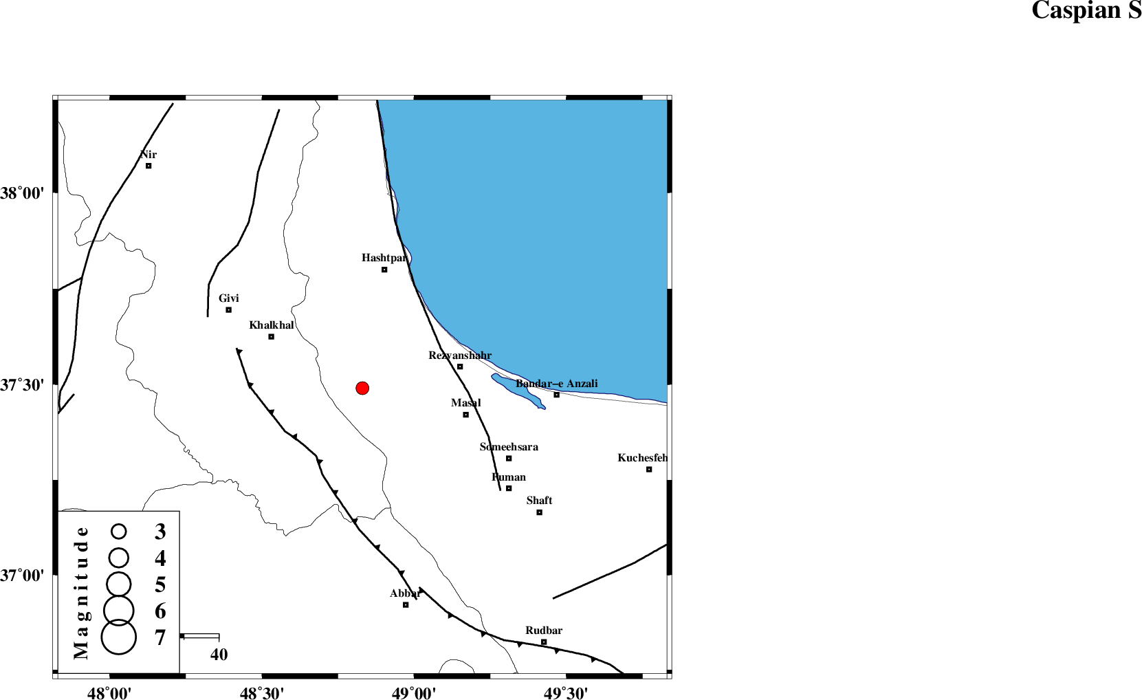
| Location | Lat:37.49 Lon: 48.83 |
| Region | Gilan Province, 29 km West of Rezvanshahr |
Nearest Cities |
|
| 8 km of Ardeh, Gilan Province | |
| 15 km North East of Kalur, Ardebil Province | |
| 17 km North of Shal, Ardebil Province | |
| 23 km West of Parrehsar, Gilan Province | |
| 24 km North East of Karin, Ardebil Province | |
| Depth | 16 km |
| Agency | |
Faults within 150 km: |
|
| MASULEL_F (Length: 90 km) , Distance to epicenter: 24 km | |
| TALESH_F (Length: 258 km) , Distance to epicenter: 26 km | |
| SANGAVAR_F (Length: 61 km) , Distance to epicenter: 49 km | |
| Number of Phases | 5 |
| RMS | 0 |
| Number of Stations | 4 |
| Error in Latitude | >1.1 km |
| Error in Longitude | 3.8 km |
| Error in Depth | 3.5 km |
Download waveform in seisan format
to download seisan software Click here
to access information about IIEES stations Click here
Amplitude | ||||||||
| UID | Agency | Station | Component | Amplitude | Period | Arrival Time | Proccessing Time | Signal Clip |
| 86820 | IIEES | GRMI | N | 107.7 | 0.35 | 2012-11-04 05:37:38 | 2012-11-04 05:42:00 | n |
Phase | ||||||||||||
| Agency | Station | Component | Phase Type | Phase Quality | First Motion | Observed Arrival Time | Time Residual | Loc. Flag | Input Weight | Distance | Azimuth | |
| IIEES | ZNJK | Z | Pg | E | 2012-11-04 05:37:04 | 0.09 | y | 91.9 | 188 | |||
| IIEES | ZNJK | N | Sg | E | 2012-11-04 05:37:15 | -0.06 | y | 91.9 | 188 | |||
| IIEES | GRMI | Z | Pg | E | 2012-11-04 05:37:15 | -0.02 | y | 168 | 331 | |||
| IIEES | CHTH | Z | Pn | E | 2012-11-04 05:37:29 | -0.02 | y | 270 | 130 | |||
| IIEES | SNGE | Z | Pn | E | 2012-11-04 05:37:32 | 0.01 | y | 298 | 207 | |||