
Magnitude |
:1.7 |
| Date & Time (UTC) | 2012-10-22 19:45:45.8 |
| Date & Time (Local) | 1391/8/1 23:15:45.8 |
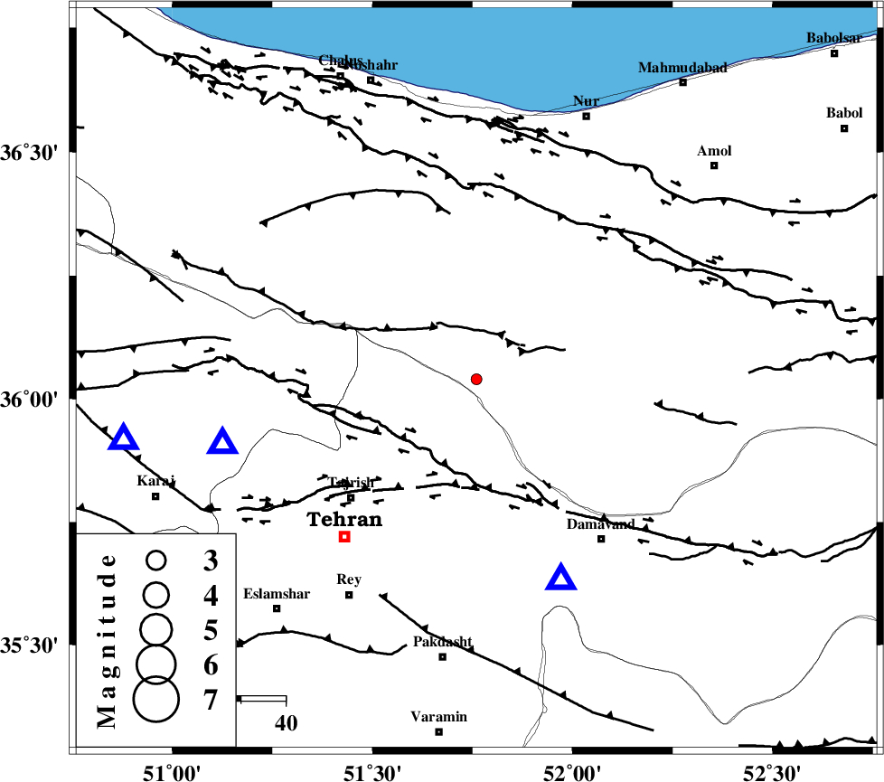
| Location | Lat:36.04 Lon: 51.76 |
| Region | Mazandaran Province, 39 km North-East of Tajrish |
Nearest Cities |
|
| 18 km South of Baladeh, Mazandaran Province | |
| 21 km North of Afjeh, Tehran Province | |
| 24 km North East of Fasham, Tehran Province | |
| 25 km North of Lavasan, Tehran Province | |
| 26 km North East of Meygon, Tehran Province | |
| Depth | 15 km |
| Agency | |
Faults within 150 km: |
|
| KANDOVAN_F (Length: 90 km) , Distance to epicenter: 14 km | |
| MOSHA_F (Length: 234 km) , Distance to epicenter: 20 km | |
| N_TEHRAN_F4 (Length: 115 km) , Distance to epicenter: 24 km | |
| Number of Phases | 5 |
| RMS | 0.3 |
| Number of Stations | 4 |
| Error in Latitude | >5.4 km |
| Error in Longitude | 4.8 km |
| Error in Depth | 8.4 km |
Download waveform in seisan format
to download seisan software Click here
to access information about IIEES stations Click here
Amplitude | ||||||||
| UID | Agency | Station | Component | Amplitude | Period | Arrival Time | Proccessing Time | Signal Clip |
| 86712 | IIEES | ASAO | E | 5.5 | 0.56 | 2012-10-22 19:46:52 | 2012-10-23 04:43:00 | n |
Phase | ||||||||||||
| Agency | Station | Component | Phase Type | Phase Quality | First Motion | Observed Arrival Time | Time Residual | Loc. Flag | Input Weight | Distance | Azimuth | |
| IIEES | DAMV | Z | Pg | E | 2012-10-22 19:45:54 | 0.01 | y | 49.1 | 157 | |||
| IIEES | CHTH | Z | Pg | E | 2012-10-22 19:45:55 | -0.46 | y | 58.8 | 256 | |||
| IIEES | THKV | Z | Pg | E | 2012-10-22 19:46:00 | 0.43 | y | 80.5 | 261 | |||
| IIEES | ASAO | E | Pn | E | 2012-10-22 19:46:22 | -0.01 | y | 228 | 224 | |||
| IIEES | ASAO | E | Sg | E | 2012-10-22 19:46:50 | 0.03 | y | 228 | 224 | |||