
Magnitude |
:2.4 |
| Date & Time (UTC) | 2012-10-13 18:06:32.7 |
| Date & Time (Local) | 1391/7/22 21:36:32.7 |
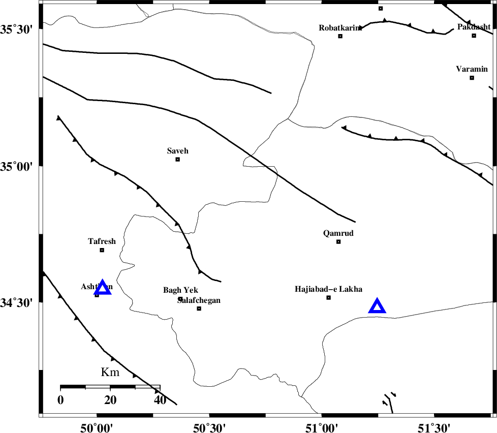
| Location | Lat:34.84 Lon: 50.76 |
| Region | Qom Province, 24 km North-West of Qom |
Nearest Cities |
|
| 22 km North East of Gazran, Qom Province | |
| 23 km North West of Qom, Qom Province | |
| 25 km South East of Taraznahid, Markazi Province | |
| 31 km North West of Qamrud, Qom Province | |
| 36 km East of Qareh chay, Markazi Province | |
| Depth | 34 km |
| Agency | |
Faults within 150 km: |
|
| KUSHK_E_NOSRAT_F (Length: 230 km) , Distance to epicenter: 15 km | |
| INDES_F (Length: 98 km) , Distance to epicenter: 35 km | |
| SIAHKUH_F (Length: 154 km) , Distance to epicenter: 47 km | |
| Number of Phases | 6 |
| RMS | 0.1 |
| Number of Stations | 4 |
| Error in Latitude | >1.5 km |
| Error in Longitude | 2.4 km |
| Error in Depth | 8.1 km |
Download waveform in seisan format
to download seisan software Click here
to access information about IIEES stations Click here
Amplitude | ||||||||
| UID | Agency | Station | Component | Amplitude | Period | Arrival Time | Proccessing Time | Signal Clip |
| 86564 | IIEES | GHVR | N | 181.5 | 0.44 | 2012-10-13 18:06:52 | 2012-10-13 09:14:00 | n |
| 86565 | IIEES | ASAO | E | 161.1 | 0.24 | 2012-10-13 18:06:56 | 2012-10-13 09:14:00 | n |
Phase | ||||||||||||
| Agency | Station | Component | Phase Type | Phase Quality | First Motion | Observed Arrival Time | Time Residual | Loc. Flag | Input Weight | Distance | Azimuth | |
| IIEES | GHVR | Z | Pg | E | 2012-10-13 18:06:43 | -0.1 | y | 60.1 | 131 | |||
| IIEES | GHVR | E | Sg | E | 2012-10-13 18:06:52 | 0.06 | y | 60.1 | 131 | |||
| IIEES | ASAO | Z | Pg | E | 2012-10-13 18:06:46 | -0.01 | y | 74.3 | 244 | |||
| IIEES | CHTH | Z | Pg | E | 2012-10-13 18:06:53 | 0.01 | y | 123 | 16 | |||
| IIEES | KHMZ | Z | Pg | E | 2012-10-13 18:06:56 | 0.07 | y | 142 | 211 | |||
| IIEES | KHMZ | N | Sg | E | 2012-10-13 18:07:13 | -0.02 | y | 142 | 211 | |||