
Magnitude |
:2.5 |
| Date & Time (UTC) | 2012-10-07 19:37:56.3 |
| Date & Time (Local) | 1391/7/16 23:07:56.3 |
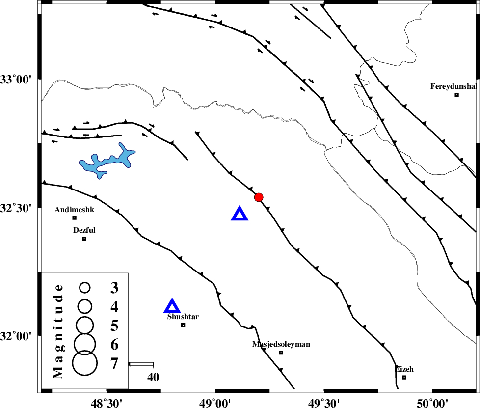
| Location | Lat:32.54 Lon: 49.2 |
| Region | Khoozestan Province, 18 km North of Lali |
Nearest Cities |
|
| 19 km North of Lali, Khoozestan Province | |
| 31 km North of Jaefarabad, Khoozestan Province | |
| 34 km North East of Sardasht, Khoozestan Province | |
| 43 km North West of Qale-yekhvaju, Khoozestan Province | |
| 44 km North West of Paabshalal, Khoozestan Province | |
| Depth | 18 km |
| Agency | |
Faults within 150 km: |
|
| MFF2 (Length: 205 km) , Distance to epicenter: 3 km | |
| BALARUD_F_Z2 (Length: 58 km) , Distance to epicenter: 35 km | |
| DEZFUL_EMBAYMENT (Length: 228 km) , Distance to epicenter: 42 km | |
| Number of Phases | 4 |
| RMS | 0 |
| Number of Stations | 3 |
| Error in Latitude | >2.8 km |
| Error in Longitude | 5.9 km |
| Error in Depth | 3.4 km |
Download waveform in seisan format
to download seisan software Click here
to access information about IIEES stations Click here
Amplitude | ||||||||
| UID | Agency | Station | Component | Amplitude | Period | Arrival Time | Proccessing Time | Signal Clip |
| 86447 | IIEES | SHGR | E | 286.4 | 0.48 | 2012-10-07 19:38:21 | 2012-10-07 08:41:00 | n |
Phase | ||||||||||||
| Agency | Station | Component | Phase Type | Phase Quality | First Motion | Observed Arrival Time | Time Residual | Loc. Flag | Input Weight | Distance | Azimuth | |
| IIEES | SHGR | Z | Pg | E | 2012-10-07 19:38:07 | 0.01 | y | 60.4 | 218 | |||
| IIEES | ASAO | Z | Pn | E | 2012-10-07 19:38:33 | -0.02 | y | 236 | 19 | |||
| IIEES | ASAO | E | Sg | E | 2012-10-07 19:39:03 | 0.01 | y | 236 | 19 | |||
| IIEES | SNGE | Z | Pn | E | 2012-10-07 19:38:44 | 0 | y | 331 | 329 | |||