
Magnitude |
:2.2 |
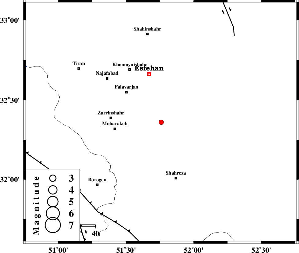
| Date & Time (UTC) | 2012-10-01 11:42:23.7 |
| Date & Time (Local) | 1391/7/10 15:12:23.7 |
| Location | Lat:32.36 Lon: 51.76 |
| Region | Esfahan Province, 32 km East of Mobarakeh |
Nearest Cities |
|
| 10 km North of Mahyar, Esfahan Province | |
| 18 km East of Kholanjan, Esfahan Province | |
| 19 km South of Dashti, Esfahan Province | |
| 21 km North East of Talkhoncheh, Esfahan Province | |
| 23 km East of Sahrufiroozan, Esfahan Province | |
| Depth | 14 km |
| Agency | |
Faults within 150 km: |
|
| MAIN_ZAGROS_R_F (Length: 1106 km) , Distance to epicenter: 75 km | |
| ZEFREH_F (Length: 124 km) , Distance to epicenter: 78 km | |
| DENA_F (Length: 137 km) , Distance to epicenter: 80 km | |
| Number of Phases | 6 |
| RMS | 0.2 |
| Number of Stations | 5 |
| Error in Latitude | >7.2 km |
| Error in Longitude | 6 km |
| Error in Depth | 9.7 km |
Download waveform in seisan format
to download seisan software Click here
to access information about IIEES stations Click here
Amplitude | ||||||||
| UID | Agency | Station | Component | Amplitude | Period | Arrival Time | Proccessing Time | Signal Clip |
| 86371 | IIEES | YZKH | E | 12.5 | 0.46 | 2012-10-01 11:43:41 | 2012-10-01 12:05:00 | n |
Phase | ||||||||||||
| Agency | Station | Component | Phase Type | Phase Quality | First Motion | Observed Arrival Time | Time Residual | Loc. Flag | Input Weight | Distance | Azimuth | |
| IIEES | NASN | Z | Pg | E | 2012-10-01 11:42:42 | -0.18 | y | 110 | 63 | |||
| IIEES | KHMZ | Z | Pn | E | 2012-10-01 11:42:59 | -0.15 | y | 227 | 313 | |||
| IIEES | GHVR | Z | Pn | E | 2012-10-01 11:43:01 | 0.16 | y | 240 | 349 | |||
| IIEES | GHVR | N | Sg | E | 2012-10-01 11:43:31 | 0.17 | y | 240 | 349 | |||
| IIEES | ASAO | Z | Pn | E | 2012-10-01 11:43:08 | 0.34 | y | 292 | 327 | |||
| IIEES | ASAO | E | Sg | E | 2012-10-01 11:43:45 | -0.33 | y | 292 | 327 | |||