
Magnitude |
:2.3 |
| Date & Time (UTC) | 2012-09-29 22:23:05.6 |
| Date & Time (Local) | 1391/7/9 01:53:05.6 |
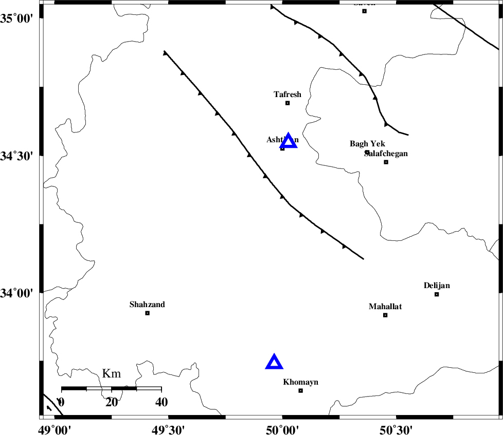
| Location | Lat:34.3 Lon: 49.95 |
| Region | Markazi Province, 26 km South of Ashtiyan |
Nearest Cities |
|
| 8 km North of Davoodabad, Markazi Province | |
| 14 km North of Ebrahimabad, Markazi Province | |
| 23 km North East of Ebakabad, Markazi Province | |
| 25 km West of Salehabad, Markazi Province | |
| 26 km South of Ashtiyan, Markazi Province | |
| Depth | 11 km |
| Agency | |
Faults within 150 km: |
|
| TAFRESH_F (Length: 117 km) , Distance to epicenter: 8 km | |
| INDES_F (Length: 98 km) , Distance to epicenter: 58 km | |
| KUSHK_E_NOSRAT_F (Length: 230 km) , Distance to epicenter: 105 km | |
| Number of Phases | 4 |
| RMS | 0 |
| Number of Stations | 4 |
| Error in Latitude | >1.4 km |
| Error in Longitude | 2.7 km |
| Error in Depth | 3.5 km |
Download waveform in seisan format
to download seisan software Click here
to access information about IIEES stations Click here
Amplitude | ||||||||
| UID | Agency | Station | Component | Amplitude | Period | Arrival Time | Proccessing Time | Signal Clip |
| 86341 | IIEES | ASAO | E | 420.2 | 0.36 | 2012-09-29 22:23:16 | 2012-09-30 02:54:00 | n |
| 86342 | IIEES | KHMZ | N | 112.8 | 0.16 | 2012-09-29 22:23:25 | 2012-09-30 02:54:00 | n |
| 86343 | IIEES | KHMZ | E | 135.5 | 0.2 | 2012-09-29 22:23:25 | 2012-09-30 02:54:00 | n |
| 86344 | IIEES | GHVR | N | 72.4 | 0.44 | 2012-09-29 22:23:45 | 2012-09-30 02:54:00 | n |
| 86345 | IIEES | GHVR | E | 66 | 0.32 | 2012-09-29 22:23:48 | 2012-09-30 02:54:00 | n |
| 86346 | IIEES | SNGE | E | 17 | 0.28 | 2012-09-29 22:24:19 | 2012-09-30 02:54:00 | n |
| 86347 | IIEES | SNGE | N | 29.6 | 0.52 | 2012-09-29 22:24:23 | 2012-09-30 02:54:00 | n |
Phase | ||||||||||||
| Agency | Station | Component | Phase Type | Phase Quality | First Motion | Observed Arrival Time | Time Residual | Loc. Flag | Input Weight | Distance | Azimuth | |
| IIEES | ASAO | Z | Pg | E | 2012-09-29 22:23:11 | -0.01 | y | 28.4 | 14 | |||
| IIEES | KHMZ | Z | Pg | E | 2012-09-29 22:23:16 | 0 | y | 62.1 | 179 | |||
| IIEES | GHVR | Z | Pg | E | 2012-09-29 22:23:26 | 0 | y | 121 | 80 | |||
| IIEES | SNGE | Z | Pn | E | 2012-09-29 22:23:45 | 0 | y | 254 | 291 | |||