
Magnitude |
:1.9 |
| Date & Time (UTC) | 2012-09-25 09:07:21.3 |
| Date & Time (Local) | 1391/7/4 12:37:21.3 |
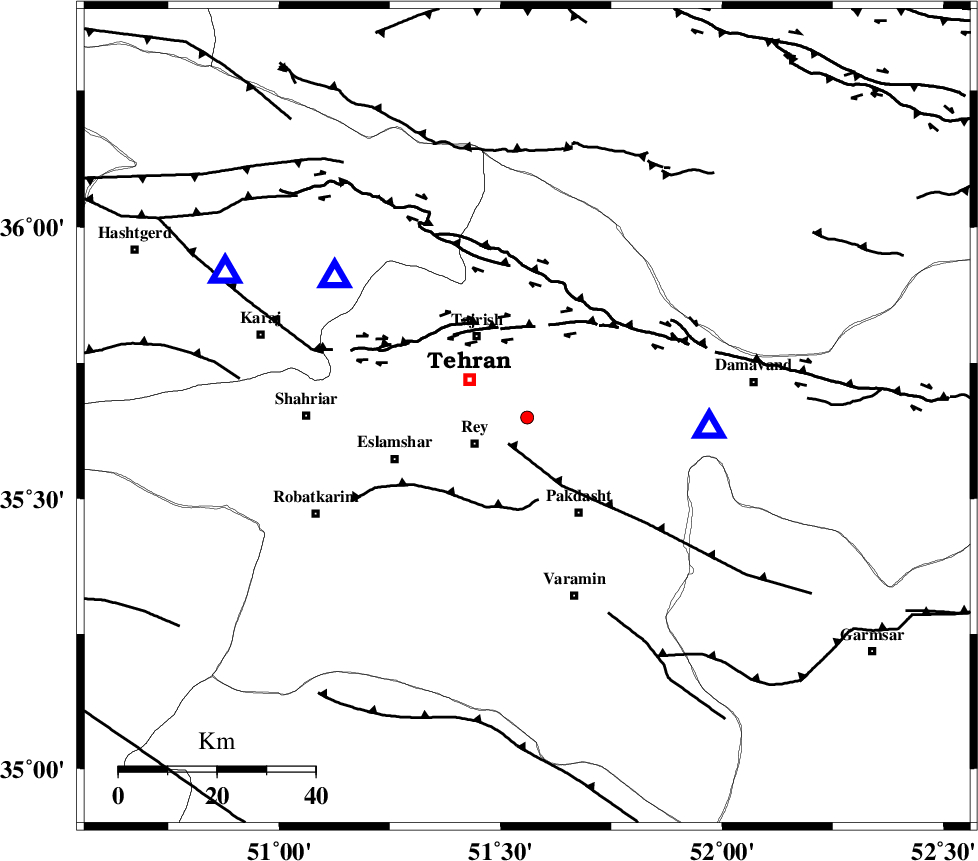
| Location | Lat:35.65 Lon: 51.56 |
| Region | Tehran Province, 12 km East of Rey |
Nearest Cities |
|
| 12 km North East of Rey, Tehran Province | |
| 15 km East of Tehran, Tehran Province | |
| 20 km South East of Tajrish, Tehran Province | |
| 22 km North West of Pakdasht, Tehran Province | |
| 23 km North East of Kahrizak, Tehran Province | |
| Depth | 18 km |
| Agency | |
Faults within 150 km: |
|
| EYVANEKEY_F (Length: 74 km) , Distance to epicenter: 7 km | |
| KAHRIZAK_F (Length: 44 km) , Distance to epicenter: 17 km | |
| N_TEHRAN_F4 (Length: 115 km) , Distance to epicenter: 18 km | |
| Number of Phases | 5 |
| RMS | 0.3 |
| Number of Stations | 4 |
| Error in Latitude | >3.3 km |
| Error in Longitude | 3.6 km |
| Error in Depth | 8.7 km |
Download waveform in seisan format
to download seisan software Click here
to access information about IIEES stations Click here
Amplitude | ||||||||
| UID | Agency | Station | Component | Amplitude | Period | Arrival Time | Proccessing Time | Signal Clip |
| 86301 | IIEES | ASAO | E | 13 | 0.49 | 2012-09-25 09:08:19 | 2012-09-26 06:35:00 | n |
Phase | ||||||||||||
| Agency | Station | Component | Phase Type | Phase Quality | First Motion | Observed Arrival Time | Time Residual | Loc. Flag | Input Weight | Distance | Azimuth | |
| IIEES | DAMV | Z | Pg | E | 2012-09-25 09:07:28 | -0.09 | y | 37.2 | 94 | |||
| IIEES | CHTH | Z | Pg | E | 2012-09-25 09:07:30 | 0.07 | y | 48.4 | 306 | |||
| IIEES | GHVR | Z | Pg | E | 2012-09-25 09:07:44 | 0.46 | y | 133 | 193 | |||
| IIEES | GHVR | E | S | E | 2012-09-25 09:07:59 | -0.14 | y | 133 | 193 | |||
| IIEES | ASAO | Z | Pg | E | 2012-09-25 09:07:51 | -0.3 | y | 186 | 229 | |||