
Magnitude |
:3.2 |
| Date & Time (UTC) | 2012-09-21 09:03:42.6 |
| Date & Time (Local) | 1391/6/31 12:33:42.6 |
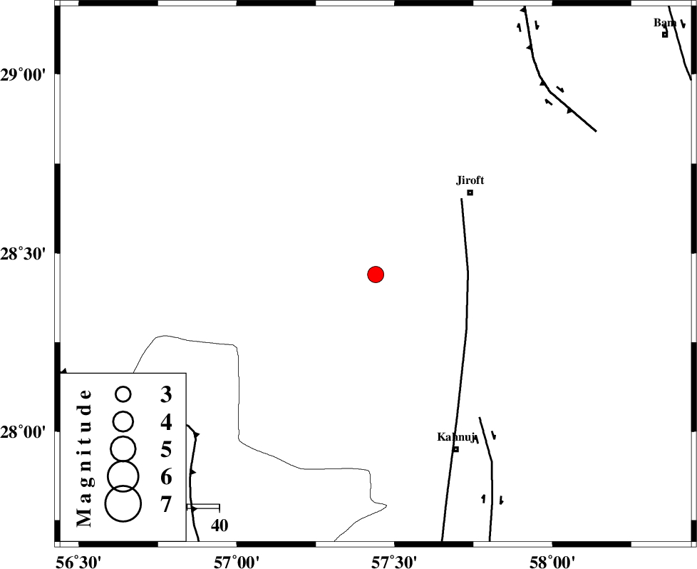
| Location | Lat:28.44 Lon: 57.44 |
| Region | Kerman Province, 39 km South-West of Jiroft |
Nearest Cities |
|
| 27 km North West of Bolock, Kerman Province | |
| 30 km North East of Hurpasefid, Kerman Province | |
| 30 km South West of Khatunabad-e zangian, Kerman Province | |
| 39 km South West of Jiroft, Kerman Province | |
| 39 km North of Mehrueye-e paeen, Kerman Province | |
| Depth | 14 km |
| Agency | |
Faults within 150 km: |
|
| SABZEVARAN_F (Length: 190 km) , Distance to epicenter: 29 km | |
| JIROFT_F (Length: 144 km) , Distance to epicenter: 55 km | |
| MAIN_ZAGROS_R_F (Length: 1106 km) , Distance to epicenter: 75 km | |
| Number of Phases | 5 |
| RMS | 0.1 |
| Number of Stations | 3 |
| Error in Latitude | >1.8 km |
| Error in Longitude | 6.9 km |
| Error in Depth | 5.2 km |
Download waveform in seisan format
to download seisan software Click here
to access information about IIEES stations Click here
Amplitude | ||||||||
| UID | Agency | Station | Component | Amplitude | Period | Arrival Time | Proccessing Time | Signal Clip |
| 86227 | IIEES | BNDS | N | 286.1 | 0.28 | 2012-09-21 09:04:34 | 2012-09-21 09:25:00 | n |
Phase | ||||||||||||
| Agency | Station | Component | Phase Type | Phase Quality | First Motion | Observed Arrival Time | Time Residual | Loc. Flag | Input Weight | Distance | Azimuth | |
| IIEES | BNDS | Z | Pg | E | 2012-09-21 09:04:10 | -0.15 | y | 170 | 227 | |||
| IIEES | BNDS | N | Sg | E | 2012-09-21 09:04:31 | 0.07 | y | 170 | 227 | |||
| IIEES | KRBR | Z | Pg | E | 2012-09-21 09:04:13 | 0.13 | y | 183 | 339 | |||
| IIEES | KRBR | N | Sg | E | 2012-09-21 09:04:35 | -0.09 | y | 183 | 339 | |||
| IIEES | GHIR | Z | Pn | E | 2012-09-21 09:04:44 | 0.05 | y | 437 | 269 | |||