
Magnitude |
:2.6 |
| Date & Time (UTC) | 2012-09-09 05:13:28.7 |
| Date & Time (Local) | 1391/6/19 09:43:28.7 |
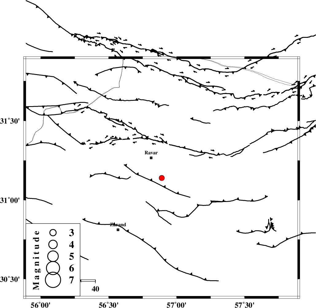
| Location | Lat:31.14 Lon: 56.89 |
| Region | Kerman Province, 16 km South of Ravar |
Nearest Cities |
|
| 16 km South of Ravar, Kerman Province | |
| 22 km South of Dehali, Kerman Province | |
| 29 km North East of Ahmadi, Kerman Province | |
| 33 km North East of Dasht-e khak, Kerman Province | |
| 34 km North East of Hatkan, Kerman Province | |
| Depth | 14 km |
| Agency | |
Faults within 150 km: |
|
| LAKARKUH_F (Length: 138 km) , Distance to epicenter: 25 km | |
| KUHBANAN_F (Length: 189 km) , Distance to epicenter: 40 km | |
| CHATRUD_F (Length: 37 km) , Distance to epicenter: 61 km | |
| Number of Phases | 5 |
| RMS | 0.2 |
| Number of Stations | 3 |
| Error in Latitude | >2.9 km |
| Error in Longitude | 5.7 km |
| Error in Depth | 9 km |
Download waveform in seisan format
to download seisan software Click here
to access information about IIEES stations Click here
Amplitude | ||||||||
| UID | Agency | Station | Component | Amplitude | Period | Arrival Time | Proccessing Time | Signal Clip |
| 86048 | IIEES | KRBR | E | 90.1 | 0.22 | 2012-09-09 05:14:07 | 2012-09-09 05:41:00 | n |
| 86049 | IIEES | YZKH | E | 34.4 | 0.45 | 2012-09-09 05:14:47 | 2012-09-09 05:41:00 | n |
| 86050 | IIEES | YZKH | N | 33.4 | 0.45 | 2012-09-09 05:14:47 | 2012-09-09 05:41:00 | n |
Phase | ||||||||||||
| Agency | Station | Component | Phase Type | Phase Quality | First Motion | Observed Arrival Time | Time Residual | Loc. Flag | Input Weight | Distance | Azimuth | |
| IIEES | KRBR | Z | Pg | E | 2012-09-09 05:13:50 | -0.28 | y | 129 | 185 | |||
| IIEES | KRBR | N | Sg | E | 2012-09-09 05:14:06 | 0.16 | y | 129 | 185 | |||
| IIEES | YZKH | Z | Pn | E | 2012-09-09 05:14:08 | 0.24 | y | 258 | 303 | |||
| IIEES | YZKH | N | Sg | E | 2012-09-09 05:14:41 | -0.11 | y | 258 | 303 | |||
| IIEES | TABS | Z | Pn | E | 2012-09-09 05:14:11 | -0.01 | y | 279 | 4 | |||