
Magnitude |
:3.1 |
| Date & Time (UTC) | 2012-09-02 04:08:15.4 |
| Date & Time (Local) | 1391/6/12 08:38:15.4 |
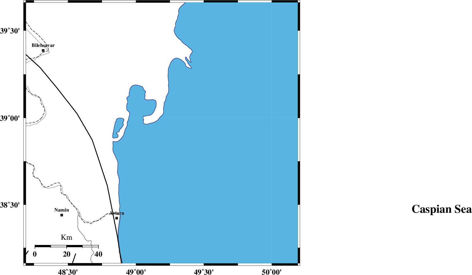
| Location | Lat:38.91 Lon: 49.19 |
| Region | Caspian Sea, 62 km North-East of Astara |
Nearest Cities |
|
| 61 km North East of Astara, Gilan Province | |
| 73 km North East of Londovil, Gilan Province | |
| 75 km North East of Kiladeh, Gilan Province | |
| 78 km North East of Anbaran, Ardebil Province | |
| 79 km South East of Hasan khanlu, Ardebil Province | |
| Depth | 6 km |
| Agency | |
Faults within 150 km: |
|
| TALESH_F (Length: 258 km) , Distance to epicenter: 44 km | |
| SANGAVAR_F (Length: 61 km) , Distance to epicenter: 95 km | |
| DASHT_E_MOGHAN__ (Length: 104 km) , Distance to epicenter: 105 km | |
| Number of Phases | 6 |
| RMS | 0.2 |
| Number of Stations | 5 |
| Error in Latitude | >6.9 km |
| Error in Longitude | 6.5 km |
| Error in Depth | 8.6 km |
Download waveform in seisan format
to download seisan software Click here
to access information about IIEES stations Click here
Amplitude | ||||||||
| UID | Agency | Station | Component | Amplitude | Period | Arrival Time | Proccessing Time | Signal Clip |
| 85915 | IIEES | GRMI | E | 548.3 | 0.25 | 2012-09-02 04:08:51 | 2012-09-02 05:15:00 | n |
Phase | ||||||||||||
| Agency | Station | Component | Phase Type | Phase Quality | First Motion | Observed Arrival Time | Time Residual | Loc. Flag | Input Weight | Distance | Azimuth | |
| IIEES | GRMI | Z | Pg | E | 2012-09-02 04:08:34 | -0.21 | y | 113 | 265 | |||
| IIEES | GRMI | N | Sg | E | 2012-09-02 04:08:49 | 0.21 | y | 113 | 265 | |||
| IIEES | ZNJK | Z | Pn | E | 2012-09-02 04:08:55 | -0.26 | y | 253 | 190 | |||
| IIEES | CHTH | Z | Pn | E | 2012-09-02 04:09:11 | 0.37 | y | 375 | 152 | |||
| IIEES | MAKU | Z | Pn | E | 2012-09-02 04:09:12 | -0.01 | y | 393 | 279 | |||
| IIEES | SNGE | Z | Pn | E | 2012-09-02 04:09:20 | -0.05 | y | 454 | 202 | |||