
Magnitude |
:3.7 |
| Date & Time (UTC) | 2012-08-28 11:49:20.8 |
| Date & Time (Local) | 1391/6/7 16:19:20.8 |
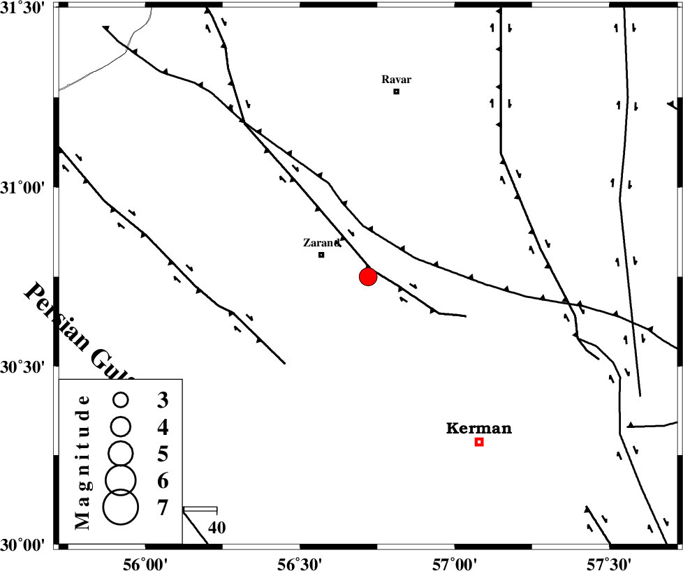
| Location | Lat:30.75 Lon: 56.72 |
| Region | Kerman Province, 16 km East of Zarand |
Nearest Cities |
|
| 7 km North of Khankuk, Kerman Province | |
| 7 km North of Bahaabad, Kerman Province | |
| 12 km of Hatkan, Kerman Province | |
| 16 km East of Zarand, Kerman Province | |
| 17 km East of Mohammadabad, Kerman Province | |
| Depth | 18 km |
| Agency | |
Faults within 150 km: |
|
| KUHBANAN_F (Length: 189 km) , Distance to epicenter: 3 km | |
| CHATRUD_F (Length: 37 km) , Distance to epicenter: 27 km | |
| DARIVAN_F (Length: 131 km) , Distance to epicenter: 37 km | |
| Number of Phases | 5 |
| RMS | 0 |
| Number of Stations | 4 |
| Error in Latitude | >1.1 km |
| Error in Longitude | 4.5 km |
| Error in Depth | 4.2 km |
Download waveform in seisan format
to download seisan software Click here
to access information about IIEES stations Click here
Amplitude | ||||||||
| UID | Agency | Station | Component | Amplitude | Period | Arrival Time | Proccessing Time | Signal Clip |
| 85843 | IIEES | YZKH | N | 347.5 | 0.32 | 2012-08-28 11:50:37 | 2012-08-28 12:03:00 | n |
Phase | ||||||||||||
| Agency | Station | Component | Phase Type | Phase Quality | First Motion | Observed Arrival Time | Time Residual | Loc. Flag | Input Weight | Distance | Azimuth | |
| IIEES | KRBR | Z | Pg | E | 2012-08-28 11:49:35 | 0 | y | 84.8 | 177 | |||
| IIEES | YZKH | Z | Pn | E | 2012-08-28 11:50:02 | 0.04 | y | 272 | 313 | |||
| IIEES | TABS | Z | Pn | E | 2012-08-28 11:50:08 | -0.04 | y | 324 | 7 | |||
| IIEES | TABS | E | Sg | E | 2012-08-28 11:50:51 | 0.02 | y | 324 | 7 | |||
| IIEES | NASN | Z | Pn | E | 2012-08-28 11:50:22 | -0.03 | y | 435 | 303 | |||