
Magnitude |
:2.4 |
| Date & Time (UTC) | 2012-08-28 00:15:42.4 |
| Date & Time (Local) | 1391/6/7 04:45:42.4 |
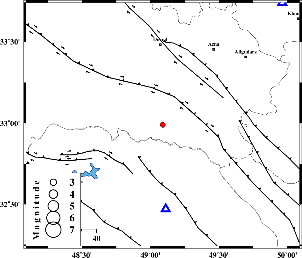
| Location | Lat:32.99 Lon: 49.09 |
| Region | Lorestan Province, 54 km South of Dorud |
Nearest Cities |
|
| 16 km East of Bargsar, Lorestan Province | |
| 24 km South of Shulabad, Lorestan Province | |
| 33 km South East of Sartang barzeh, Lorestan Province | |
| 34 km North East of Shuy, Khoozestan Province | |
| 34 km South East of Chamsangar, Lorestan Province | |
| Depth | 15 km |
| Agency | |
Faults within 150 km: |
|
| HZF4 (Length: 492 km) , Distance to epicenter: 21 km | |
| MFF2 (Length: 205 km) , Distance to epicenter: 27 km | |
| BALARUD_F_Z2 (Length: 58 km) , Distance to epicenter: 38 km | |
| Number of Phases | 5 |
| RMS | 0.1 |
| Number of Stations | 5 |
| Error in Latitude | >2.3 km |
| Error in Longitude | 3.2 km |
| Error in Depth | 4.1 km |
Download waveform in seisan format
to download seisan software Click here
to access information about IIEES stations Click here
Amplitude | ||||||||
| UID | Agency | Station | Component | Amplitude | Period | Arrival Time | Proccessing Time | Signal Clip |
| 85829 | IIEES | SHGR | N | 115.1 | 0.24 | 2012-08-28 00:16:14 | 2012-08-28 12:49:00 | n |
| 85830 | IIEES | SHGR | E | 126.7 | 0.56 | 2012-08-28 00:16:15 | 2012-08-28 12:49:00 | n |
Phase | ||||||||||||
| Agency | Station | Component | Phase Type | Phase Quality | First Motion | Observed Arrival Time | Time Residual | Loc. Flag | Input Weight | Distance | Azimuth | |
| IIEES | SHGR | Z | Pg | E | 2012-08-28 00:15:59 | 0.01 | y | 102 | 195 | |||
| IIEES | KHMZ | Z | Pg | E | 2012-08-28 00:16:02 | -0.01 | y | 116 | 44 | |||
| IIEES | ASAO | Z | Pn | E | 2012-08-28 00:16:14 | 0.09 | y | 193 | 27 | |||
| IIEES | GHVR | Z | Pn | E | 2012-08-28 00:16:22 | -0.07 | y | 259 | 50 | |||
| IIEES | SNGE | Z | Pn | E | 2012-08-28 00:16:25 | -0.03 | y | 283 | 326 | |||