
Magnitude |
:2.2 |
| Date & Time (UTC) | 2012-08-19 11:28:04.3 |
| Date & Time (Local) | 1391/5/29 15:58:04.3 |
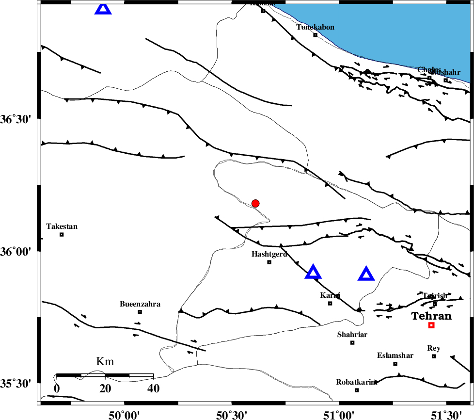
| Location | Lat:36.18 Lon: 50.61 |
| Region | Tehran Province, 17 km North of Abyek |
Nearest Cities |
|
| 5 km of Taleqan, Tehran Province | |
| 14 km West of Shahrak, Tehran Province | |
| 17 km North of Abyek, Ghazvin Province | |
| 25 km North of Hashtgerd, Tehran Province | |
| 28 km North of Nazarabad-E-Bozorg, Tehran Province | |
| Depth | 14 km |
| Agency | |
Faults within 150 km: |
|
| TALEGHAN_F (Length: 71 km) , Distance to epicenter: 14 km | |
| MOSHA_F (Length: 234 km) , Distance to epicenter: 15 km | |
| ALAMUTRUD_F (Length: 140 km) , Distance to epicenter: 20 km | |
| Number of Phases | 4 |
| RMS | 0 |
| Number of Stations | 3 |
| Error in Latitude | >9.2 km |
| Error in Longitude | 5.4 km |
| Error in Depth | 3.9 km |
Download waveform in seisan format
to download seisan software Click here
to access information about IIEES stations Click here
Amplitude | ||||||||
| UID | Agency | Station | Component | Amplitude | Period | Arrival Time | Proccessing Time | Signal Clip |
| 85606 | IIEES | THKV | N | 247.2 | 0.2 | 2012-08-19 11:28:18 | 2012-08-19 03:39:00 | n |
Phase | ||||||||||||
| Agency | Station | Component | Phase Type | Phase Quality | First Motion | Observed Arrival Time | Time Residual | Loc. Flag | Input Weight | Distance | Azimuth | |
| IIEES | THKV | Z | Pg | E | 2012-08-19 11:28:11 | 0.02 | y | 37.7 | 140 | |||
| IIEES | CHTH | Z | Pg | E | 2012-08-19 11:28:14 | -0.01 | y | 55.2 | 122 | |||
| IIEES | CHTH | E | Sg | E | 2012-08-19 11:28:21 | -0.01 | y | 55.2 | 122 | |||
| IIEES | GHVR | Z | Pn | E | 2012-08-19 11:28:36 | 0 | y | 197 | 163 | |||