
Magnitude |
:3.1 |
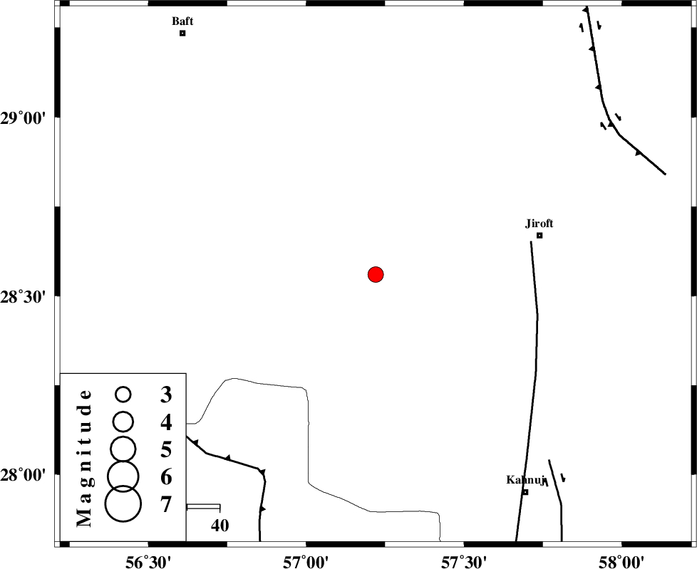
| Date & Time (UTC) | 2012-08-18 14:46:32.0 |
| Date & Time (Local) | 1391/5/28 19:16:32.0 |
| Location | Lat:28.56 Lon: 57.22 |
| Region | Kerman Province, 52 km South-West of Jiroft |
Nearest Cities |
|
| 22 km South East of Dolatabad, Kerman Province | |
| 41 km North East of Sarkhan, Kerman Province | |
| 42 km North of Hurpasefid, Kerman Province | |
| 47 km West of Khatunabad-e zangian, Kerman Province | |
| 50 km North West of Bolock, Kerman Province | |
| Depth | 35 km |
| Agency | |
Faults within 150 km: |
|
| SABZEVARAN_F (Length: 190 km) , Distance to epicenter: 49 km | |
| MAIN_ZAGROS_R_F (Length: 1106 km) , Distance to epicenter: 71 km | |
| JIROFT_F (Length: 144 km) , Distance to epicenter: 79 km | |
| Number of Phases | 4 |
| RMS | 0 |
| Number of Stations | 3 |
| Error in Latitude | >1.2 km |
| Error in Longitude | 3.6 km |
| Error in Depth | 4.2 km |
Download waveform in seisan format
to download seisan software Click here
to access information about IIEES stations Click here
Amplitude | ||||||||
| UID | Agency | Station | Component | Amplitude | Period | Arrival Time | Proccessing Time | Signal Clip |
| 85556 | IIEES | KRBR | N | 156.8 | 0.32 | 2012-08-18 14:47:33 | 2012-08-18 03:04:00 | n |
| 85557 | IIEES | BNDS | E | 334.2 | 0.32 | 2012-08-18 14:47:22 | 2012-08-18 03:04:00 | n |
| 85558 | IIEES | BNDS | N | 264.4 | 0.24 | 2012-08-18 14:47:25 | 2012-08-18 03:04:00 | n |
Phase | ||||||||||||
| Agency | Station | Component | Phase Type | Phase Quality | First Motion | Observed Arrival Time | Time Residual | Loc. Flag | Input Weight | Distance | Azimuth | |
| IIEES | KRBR | Z | Pn | E | 2012-08-18 14:46:58 | 0 | y | 164 | 344 | |||
| IIEES | KRBR | E | Sg | E | 2012-08-18 14:47:18 | 0 | y | 164 | 344 | |||
| IIEES | BNDS | Z | Pg | E | 2012-08-18 14:46:59 | 0 | y | 165 | 219 | |||
| IIEES | ZHSF | Z | Pn | E | 2012-08-18 14:47:23 | 0 | y | 365 | 71 | |||