
Magnitude |
:2.6 |
| Date & Time (UTC) | 2012-08-14 11:40:44.7 |
| Date & Time (Local) | 1391/5/24 16:10:44.7 |
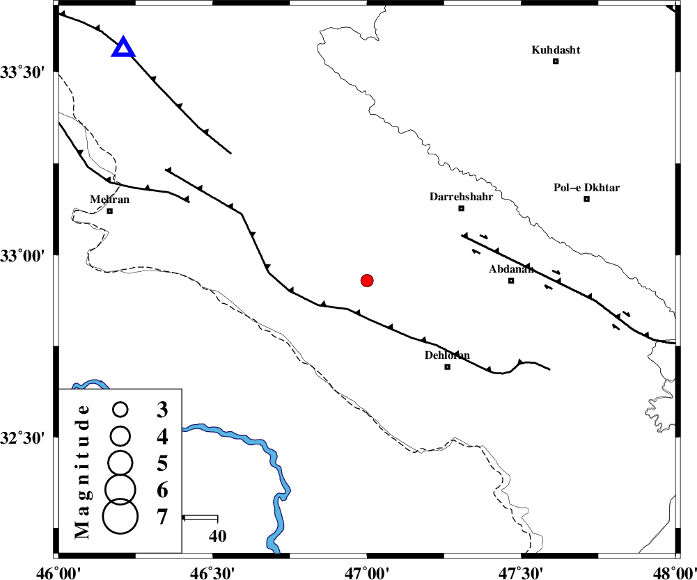
| Location | Lat:32.93 Lon: 47 |
| Region | Ilam Province, 44 km West of Abdanan |
Nearest Cities |
|
| 12 km North of Bishehzar, Ilam Province | |
| 34 km South of Meymeh, Ilam Province | |
| 36 km North West of Dehloran, Ilam Province | |
| 36 km South West of Darreh Shahr, Ilam Province | |
| 38 km South of Badreh, Ilam Province | |
| Depth | 43 km |
| Agency | |
Faults within 150 km: |
|
| MFF6 (Length: 144 km) , Distance to epicenter: 10 km | |
| BALARUD_F_Z1 (Length: 87 km) , Distance to epicenter: 32 km | |
| MFF7 (Length: 99 km) , Distance to epicenter: 56 km | |
| Number of Phases | 5 |
| RMS | 0.5 |
| Number of Stations | 3 |
| Error in Latitude | >15.1 km |
| Error in Longitude | 35.1 km |
| Error in Depth | 19 km |
Download waveform in seisan format
to download seisan software Click here
to access information about IIEES stations Click here
Amplitude | ||||||||
| UID | Agency | Station | Component | Amplitude | Period | Arrival Time | Proccessing Time | Signal Clip |
| 85322 | IIEES | SHGR | N | 52.6 | 0.44 | 2012-08-14 11:41:44 | 2012-08-14 12:13:00 | n |
| 85323 | IIEES | SHGR | E | 58 | 0.56 | 2012-08-14 11:41:51 | 2012-08-14 12:13:00 | n |
| 85324 | IIEES | SNGE | E | 32.7 | 0.52 | 2012-08-14 11:41:59 | 2012-08-14 12:13:00 | n |
Phase | ||||||||||||
| Agency | Station | Component | Phase Type | Phase Quality | First Motion | Observed Arrival Time | Time Residual | Loc. Flag | Input Weight | Distance | Azimuth | |
| IIEES | SHGR | Z | Pn | E | 2012-08-14 11:41:14 | 0.77 | y | 192 | 118 | |||
| IIEES | SHGR | N | Sg | E | 2012-08-14 11:41:38 | -0.35 | y | 192 | 118 | |||
| IIEES | SNGE | Z | Pn | E | 2012-08-14 11:41:19 | -0.75 | y | 242 | 8 | |||
| IIEES | SNGE | N | Sg | E | 2012-08-14 11:41:52 | 0.38 | y | 242 | 8 | |||
| IIEES | ASAO | Z | Pn | E | 2012-08-14 11:41:31 | -0.05 | y | 333 | 57 | |||