
Magnitude |
:2.7 |
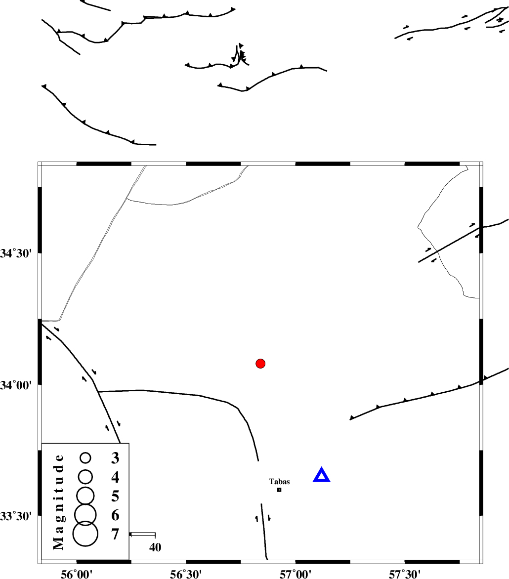
| Date & Time (UTC) | 2012-08-13 16:09:39.0 |
| Date & Time (Local) | 1391/5/23 20:39:39.0 |
| Location | Lat:34.08 Lon: 56.84 |
| Region | Yazd Province, 54 km North of Tabas |
Nearest Cities |
|
| 32 km South of Eshqabad, Yazd Province | |
| 40 km North of Jokhvah, Yazd Province | |
| 47 km North West of Qaniabad, Khorasan(center) Province | |
| 48 km North West of Reqqeh, Khorasan(center) Province | |
| 53 km North East of Halvan, Yazd Province | |
| Depth | 15 km |
| Agency | |
Faults within 150 km: |
|
| NAINI_F (Length: 342 km) , Distance to epicenter: 18 km | |
| TABAS_F1 (Length: 91 km) , Distance to epicenter: 23 km | |
| TABAS_F2 (Length: 67 km) , Distance to epicenter: 52 km | |
| Number of Phases | 4 |
| RMS | 0 |
| Number of Stations | 3 |
| Error in Latitude | >1.5 km |
| Error in Longitude | 4.9 km |
| Error in Depth | 4.3 km |
Download waveform in seisan format
to download seisan software Click here
to access information about IIEES stations Click here
Amplitude | ||||||||
| UID | Agency | Station | Component | Amplitude | Period | Arrival Time | Proccessing Time | Signal Clip |
| 85253 | IIEES | YZKH | N | 36.8 | 0.52 | 2012-08-13 16:11:01 | 2012-08-13 04:54:00 | n |
| 85254 | IIEES | YZKH | E | 37.2 | 0.32 | 2012-08-13 16:11:02 | 2012-08-13 04:54:00 | n |
Phase | ||||||||||||
| Agency | Station | Component | Phase Type | Phase Quality | First Motion | Observed Arrival Time | Time Residual | Loc. Flag | Input Weight | Distance | Azimuth | |
| IIEES | TABS | Z | Pg | E | 2012-08-13 16:09:48 | 0.01 | y | 54.6 | 152 | |||
| IIEES | SHRO | Z | Pn | E | 2012-08-13 16:10:14 | 0.01 | y | 227 | 341 | |||
| IIEES | SHRO | E | Sg | E | 2012-08-13 16:10:43 | -0.01 | y | 227 | 341 | |||
| IIEES | YZKH | Z | Pn | E | 2012-08-13 16:10:21 | -0.01 | y | 282 | 229 | |||