
Magnitude |
:2.5 |
| Date & Time (UTC) | 2012-08-12 12:50:41.9 |
| Date & Time (Local) | 1391/5/22 17:20:41.9 |
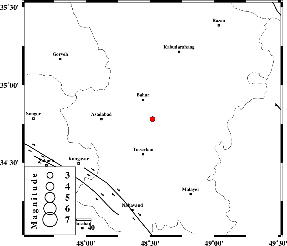
| Location | Lat:34.78 Lon: 48.52 |
| Region | Hamedan Province, 2 km Hamedan |
Nearest Cities |
|
| 2 km of Hamedan, Hamedan Province | |
| 8 km of Abshineh, Hamedan Province | |
| 8 km of Meriyanaj, Hamedan Province | |
| 9 km North of Qonjan, Hamedan Province | |
| 9 km North of Aberu, Hamedan Province | |
| Depth | 18 km |
| Agency | |
Faults within 150 km: |
|
| NAHAVAND_F (Length: 102 km) , Distance to epicenter: 56 km | |
| SAHANEH_F (Length: 77 km) , Distance to epicenter: 67 km | |
| DINEHVAR_F (Length: 46 km) , Distance to epicenter: 73 km | |
| Number of Phases | 5 |
| RMS | 0.1 |
| Number of Stations | 3 |
| Error in Latitude | >3.8 km |
| Error in Longitude | 2.3 km |
| Error in Depth | 3.7 km |
Download waveform in seisan format
to download seisan software Click here
to access information about IIEES stations Click here
Amplitude | ||||||||
| UID | Agency | Station | Component | Amplitude | Period | Arrival Time | Proccessing Time | Signal Clip |
| 85135 | IIEES | SNGE | N | 141.7 | 0.24 | 2012-08-12 12:51:16 | 2012-08-12 01:04:00 | n |
| 85136 | IIEES | SNGE | E | 93.5 | 0.24 | 2012-08-12 12:51:16 | 2012-08-12 01:04:00 | n |
Phase | ||||||||||||
| Agency | Station | Component | Phase Type | Phase Quality | First Motion | Observed Arrival Time | Time Residual | Loc. Flag | Input Weight | Distance | Azimuth | |
| IIEES | SNGE | Z | Pg | E | 2012-08-12 12:51:01 | 0.1 | y | 112 | 288 | |||
| IIEES | SNGE | N | Sg | E | 2012-08-12 12:51:14 | -0.07 | y | 112 | 288 | |||
| IIEES | ASAO | Z | Pg | E | 2012-08-12 12:51:05 | -0.02 | y | 141 | 100 | |||
| IIEES | KHMZ | Z | Pn | E | 2012-08-12 12:51:11 | -0.01 | y | 176 | 130 | |||
| IIEES | KHMZ | E | Sg | E | 2012-08-12 12:51:32 | 0 | y | 176 | 130 | |||