
Magnitude |
:3.3 |
| Date & Time (UTC) | 2012-08-08 04:03:35.9 |
| Date & Time (Local) | 1391/5/18 08:33:35.9 |
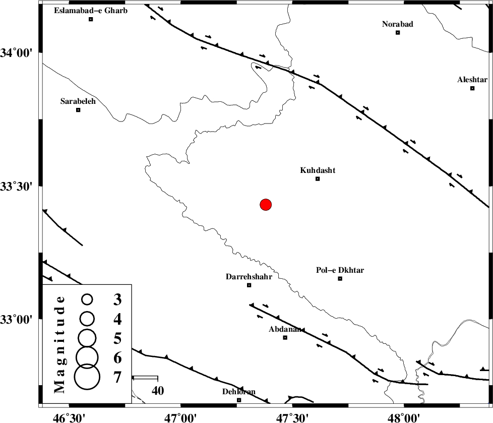
| Location | Lat:33.43 Lon: 47.38 |
| Region | Lorestan Province, 24 km West of Kuhdasht |
Nearest Cities |
|
| 5 km North of Kunani, Lorestan Province | |
| 12 km West of Ashtarheh golgol, Lorestan Province | |
| 13 km North of Suri, Lorestan Province | |
| 13 km East of Garab, Lorestan Province | |
| 19 km North of Chaqabol, Lorestan Province | |
| Depth | 14 km |
| Agency | |
Faults within 150 km: |
|
| BALARUD_F_Z1 (Length: 87 km) , Distance to epicenter: 42 km | |
| HZF4 (Length: 492 km) , Distance to epicenter: 55 km | |
| MFF6 (Length: 144 km) , Distance to epicenter: 76 km | |
| Number of Phases | 9 |
| RMS | 0.3 |
| Number of Stations | 8 |
| Error in Latitude | >4.5 km |
| Error in Longitude | 5.3 km |
| Error in Depth | 6.5 km |
Download waveform in seisan format
to download seisan software Click here
to access information about IIEES stations Click here
Amplitude | ||||||||
| UID | Agency | Station | Component | Amplitude | Period | Arrival Time | Proccessing Time | Signal Clip |
| 84834 | IIEES | SNGE | N | 267.4 | 0.28 | 2012-08-08 04:04:32 | 2012-08-08 04:22:00 | n |
| 84835 | IIEES | SNGE | E | 560.7 | 0.58 | 2012-08-08 04:04:35 | 2012-08-08 04:22:00 | n |
| 84836 | IIEES | ASAO | E | 80.1 | 0.61 | 2012-08-08 04:04:55 | 2012-08-08 04:22:00 | n |
Phase | ||||||||||||
| Agency | Station | Component | Phase Type | Phase Quality | First Motion | Observed Arrival Time | Time Residual | Loc. Flag | Input Weight | Distance | Azimuth | |
| IIEES | SNGE | Z | Pg | E | 2012-08-08 04:04:06 | -0.05 | y | 185 | 359 | |||
| IIEES | SHGR | Z | Pg | E | 2012-08-08 04:04:08 | 0.02 | y | 198 | 137 | |||
| IIEES | KHMZ | Z | Pn | E | 2012-08-08 04:04:13 | -0.08 | y | 243 | 81 | |||
| IIEES | KHMZ | N | Sg | E | 2012-08-08 04:04:44 | 0.03 | y | 243 | 81 | |||
| IIEES | ASAO | Z | Pn | E | 2012-08-08 04:04:18 | 0.77 | y | 274 | 62 | |||
| IIEES | GHVR | Z | Pn | E | 2012-08-08 04:04:29 | -0.38 | y | 376 | 71 | |||
| IIEES | CHTH | Z | Pn | E | 2012-08-08 04:04:38 | -0.21 | y | 440 | 50 | |||
| IIEES | DAMV | Z | Pn | E | 2012-08-08 04:04:43 | -0.45 | y | 487 | 59 | |||
| IIEES | GRMI | Z | Pn | E | 2012-08-08 04:04:58 | 0.19 | y | 599 | 4 | |||