
Magnitude |
:2.8 |
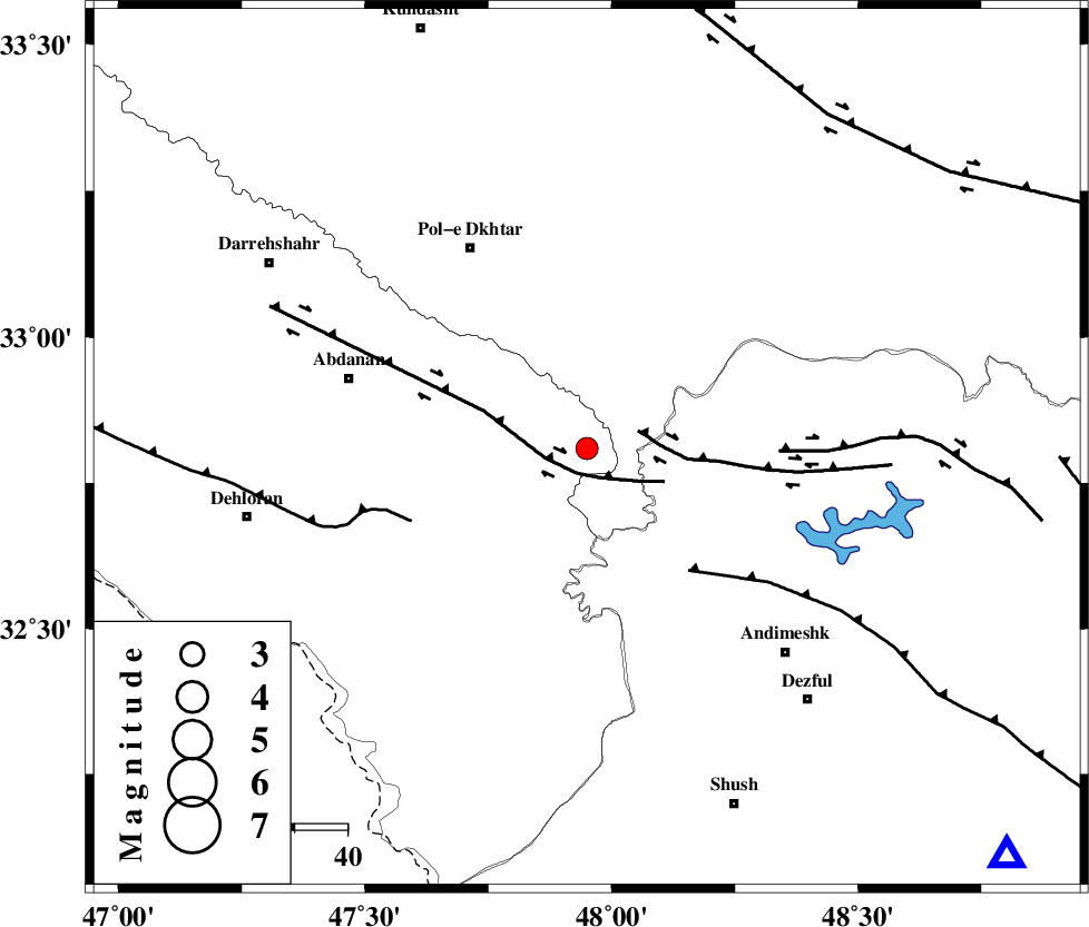
| Date & Time (UTC) | 2012-07-29 21:56:08.7 |
| Date & Time (Local) | 1391/5/9 02:26:08.7 |
| Location | Lat:32.81 Lon: 47.95 |
| Region | Ilam Province, 44 km South-East of Pol-e dokhtar |
Nearest Cities |
|
| 27 km North West of Bidruyeh, Khoozestan Province | |
| 31 km North West of Hoseinieh, Khoozestan Province | |
| 36 km North West of Sorkhakan, Khoozestan Province | |
| 37 km East of Sarabbagh, Ilam Province | |
| 40 km South East of Sarab hammam, Lorestan Province | |
| Depth | 17 km |
| Agency | |
Faults within 150 km: |
|
| BALARUD_F_Z1 (Length: 87 km) , Distance to epicenter: 5 km | |
| BALARUD_F_Z3 (Length: 53 km) , Distance to epicenter: 10 km | |
| DEZFUL_EMBAYMENT (Length: 228 km) , Distance to epicenter: 30 km | |
| Number of Phases | 6 |
| RMS | 0.1 |
| Number of Stations | 4 |
| Error in Latitude | >1.7 km |
| Error in Longitude | 5.3 km |
| Error in Depth | 5.8 km |
Download waveform in seisan format
to download seisan software Click here
to access information about IIEES stations Click here
Amplitude | ||||||||
| UID | Agency | Station | Component | Amplitude | Period | Arrival Time | Proccessing Time | Signal Clip |
| 84666 | IIEES | SHGR | E | 286.5 | 0.28 | 2012-07-29 21:56:45 | 2012-07-29 10:07:00 | n |
| 84667 | IIEES | GHVR | E | 29.1 | 0.68 | 2012-07-29 21:57:45 | 2012-07-29 10:07:00 | n |
| 84668 | IIEES | GHVR | N | 14.8 | 0.52 | 2012-07-29 21:58:03 | 2012-07-29 10:07:00 | n |
Phase | ||||||||||||
| Agency | Station | Component | Phase Type | Phase Quality | First Motion | Observed Arrival Time | Time Residual | Loc. Flag | Input Weight | Distance | Azimuth | |
| IIEES | SHGR | Z | Pg | E | 2012-07-29 21:56:27 | -0.01 | y | 112 | 134 | |||
| IIEES | SHGR | N | Sg | E | 2012-07-29 21:56:41 | 0.01 | y | 112 | 134 | |||
| IIEES | KHMZ | Z | Pn | E | 2012-07-29 21:56:42 | -0.12 | y | 214 | 61 | |||
| IIEES | KHMZ | E | Sg | E | 2012-07-29 21:57:09 | 0 | y | 214 | 61 | |||
| IIEES | ASAO | Z | Pn | E | 2012-07-29 21:56:50 | 0.01 | y | 272 | 44 | |||
| IIEES | GHVR | Z | Pn | E | 2012-07-29 21:57:00 | 0.13 | y | 357 | 58 | |||