
Magnitude |
:2.8 |
| Date & Time (UTC) | 2012-07-28 15:28:52.2 |
| Date & Time (Local) | 1391/5/7 19:58:52.2 |
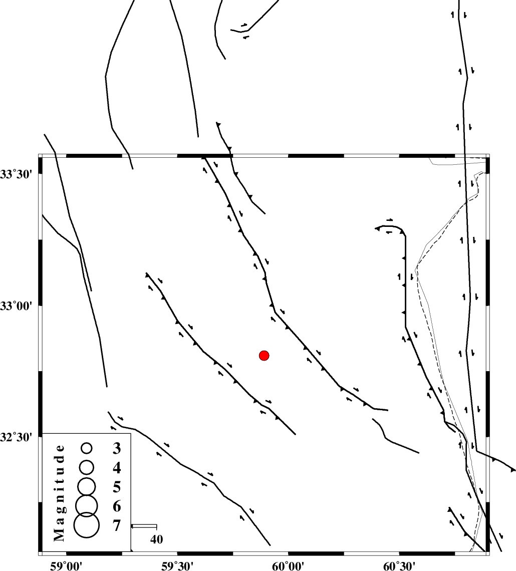
| Location | Lat:32.81 Lon: 59.89 |
| Region | Khorasan(south) Province, 23 km North-East of Sarbisheh |
Nearest Cities |
|
| 3 km of Darmian, Khorasan(south) Province | |
| 22 km South East of Asadieh, Khorasan(south) Province | |
| 23 km North of Sarbisheh, Khorasan(south) Province | |
| 28 km North of Salmabad, Khorasan(south) Province | |
| 31 km North West of Tabas masina, Khorasan(south) Province | |
| Depth | 14 km |
| Agency | |
Faults within 150 km: |
|
| NOZAD_F (Length: 27 km) , Distance to epicenter: 15 km | |
| ABRIZ_F (Length: 114 km) , Distance to epicenter: 52 km | |
| MOHAMMADABAD_F (Length: 71 km) , Distance to epicenter: 64 km | |
| Number of Phases | 4 |
| RMS | 0 |
| Number of Stations | 3 |
| Error in Latitude | >3 km |
| Error in Longitude | 11.5 km |
| Error in Depth | 18.3 km |
Download waveform in seisan format
to download seisan software Click here
to access information about IIEES stations Click here
Amplitude | ||||||||
| UID | Agency | Station | Component | Amplitude | Period | Arrival Time | Proccessing Time | Signal Clip |
| 84646 | IIEES | SHRT | E | 260.3 | 0.24 | 2012-07-28 15:29:23 | 2012-07-28 04:26:00 | n |
| 84647 | IIEES | SHRT | N | 350.8 | 0.36 | 2012-07-28 15:29:25 | 2012-07-28 04:26:00 | n |
Phase | ||||||||||||
| Agency | Station | Component | Phase Type | Phase Quality | First Motion | Observed Arrival Time | Time Residual | Loc. Flag | Input Weight | Distance | Azimuth | |
| IIEES | SHRT | Z | Pg | E | 2012-07-28 15:29:09 | -0.01 | y | 100 | 22 | |||
| IIEES | SHRT | N | Sg | E | 2012-07-28 15:29:21 | 0.01 | y | 100 | 22 | |||
| IIEES | TABS | Z | Pn | E | 2012-07-28 15:29:34 | 0 | y | 275 | 291 | |||
| IIEES | KRBR | Z | Pn | E | 2012-07-28 15:29:53 | 0.01 | y | 432 | 224 | |||